Old Boundary Marker

-
Description
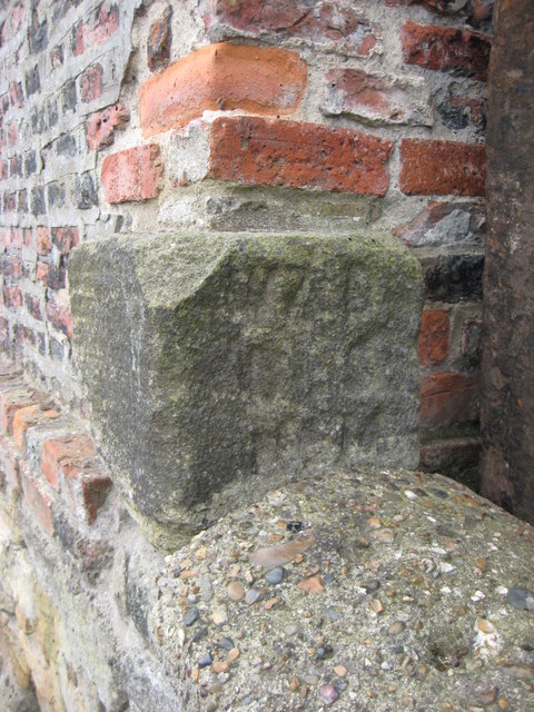
"War Department Boundary Marker set in the west face of the northwest corner of the site of Cliffords Fort and Ballards smokehouse, Union Road, North Shields. It’s at the foot of a brick wall where it ends above a stone wall. Inscribed W ↑ D / BS / No. 16. Grade II Listed https://historicengland.org.uk/listing/the-list/list-entry/1299778. Milestone Society National ID: NB_WDNSH16em" Photo by Mike Rayner, 2019. -
Owner
Mike Rayner -
Source
Geograph (Geograph) -
License
What does this mean? Creative Commons License
-
Further information
Link: http://www.geograph.org.uk/photo/6458340
Resource type: Image
Added by: Simon Cotterill
Last modified: 1 year, 10 months ago
Viewed: 360 times
Picture Taken: 2019-07-21 -
Co-Curate tags


