Coquetdale near Harbottle


-
Description
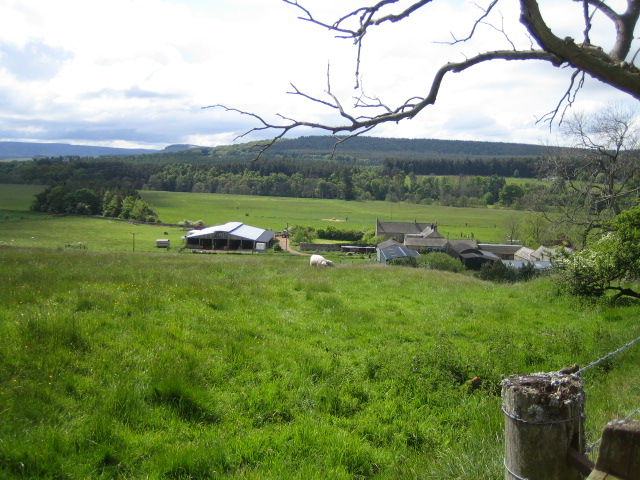
"This view looking south is of the valley of the River Coquet, Coquetdale, east of Harbottle. The buildings are part of the farm called The Peels. The first line of trees across the photo in the middle distance hide the river, and the hills beyond are in the Otterburn army training area. The hills in the far distance on the left are part of the Simonside Hills that overlook Thropton and Rothbury." Photo by Andy Gryce, 2007. -
Owner
Andy Gryce -
Source
Geograph (Geograph) -
License
What does this mean? Creative Commons License
-
Further information
Link: http://www.geograph.org.uk/photo/457194
Resource type: Image
Added by: Simon Cotterill
Last modified: 3 years ago
Viewed: 469 times
Picture Taken: 2007-05-27 -
Co-Curate tags


