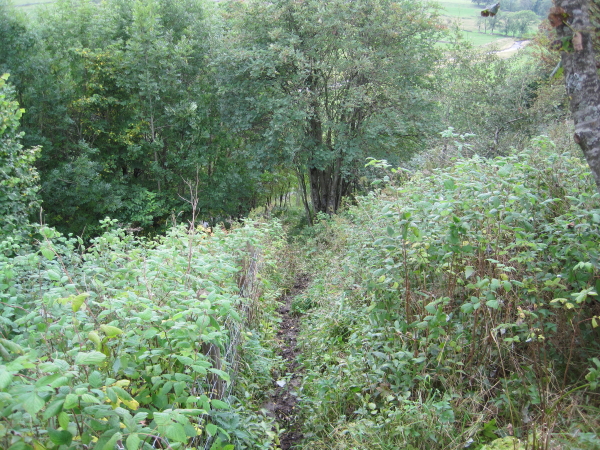
Isaac's Tea Trail leading to Nenthall Bridge


-
Description
"We had decided to walk from Nenthead to Alston following The Isaac’s Tea Trail but we never made it because we found it slow going and tedious. This particular part of the trail could be extremely dangerous because it was very slippy due to recent rain and would be even more difficult when it becomes wetter. There was a fence one could onto but was barbed, there were steps further down near the road. This was the most disappointing walk we had done for ages. Considering the industrial heritage that abounds in the area we saw very little. Surely the Tea Trail could incorporate some of these. No doubt there will be a multitude of people out there who will disagree." Photo by Les Hull, 2010. -
Owner
Les Hull -
Source
Geograph (Geograph) -
License
What does this mean? Creative Commons License
-
Further information
Link: http://www.geograph.org.uk/photo/2098832
Resource type: Image
Added by: Edmund Anon
Last modified: 4 years, 4 months ago
Viewed: 571 times
Picture Taken: 2010-09-22 -
Co-Curate tags


