Milestone, Bayles


-
Description
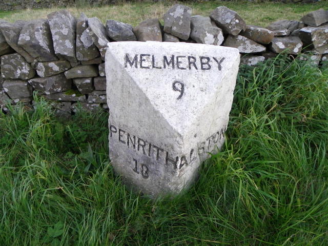
"The milestone is beside the A686. It tells us that it is 18 miles to Penrith, 9 miles to Melmerby and 1 mile to Alston. There is an Ordnance Survey bench mark on the top of it. The stone dates from the 19th century and was placed for the Alston Turnpike Trust. Milestones did not come into general use until the Turnpike Act of 1766 made them compulsory on turnpike roads, these roads were built by private enterprise under licence from the Government and maintained by tolls on those who used them. Before this Act milestones were put up occasionally, often as charitable acts and commemorations. Many Turnpike Act stones still exist. They are usually 2-3 ft high, with the initial letter or abbreviation of the nearest market town show on two faces, and the distance from it." Photo by Maigheach-gheal, 2010. -
Owner
Maigheach-gheal -
Source
Geograph (Geograph) -
License
What does this mean? Creative Commons License
-
Further information
Link: http://www.geograph.org.uk/photo/2190857
Resource type: Image
Added by: Simon Cotterill
Last modified: 4 years, 4 months ago
Viewed: 672 times
Picture Taken: 2010-10-16 -
Co-Curate tags


