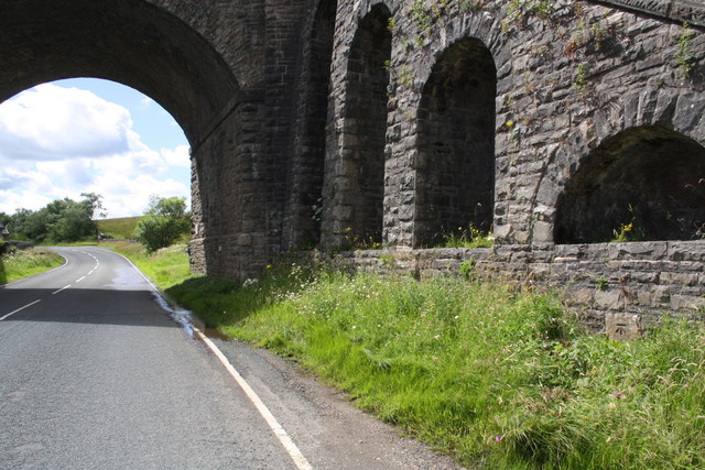
Railway bridge taking S&C Railway over the A684 by Moorcock Cottages

-
Description
"There is an Ordnance Survey benchmark [[1899111]] on a stone the abutment wall near the right hand edge of the image. Previously (before the construction of the Settle to Carlisle Railway) there was a milestone at this location which had a benchmark levelled on it at 1078.163 feet above Liverpool Datum during the 1845 Kendal to Thirsk 1GL Survey. The surveyor's description was 'No. 61. Mark on top of 10th milestone from Sedbergh and 6th from Hawes : 3.29 ft. above centre of road'" Photo by Roger Templeman, 2016. -
Owner
Roger Templeman -
Source
Geograph (Geograph) -
License
What does this mean? Creative Commons License
-
Further information
Link: http://www.geograph.org.uk/photo/5282886
Resource type: Image
Added by: Simon Cotterill
Last modified: 4 years, 10 months ago
Viewed: 673 times
Picture Taken: 2016-07-27 -
Co-Curate tags


