Farm building, Dale Croft

  • Description

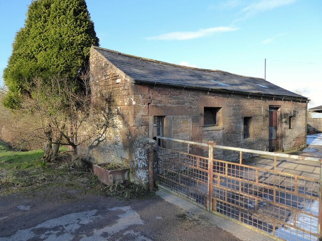
    "Beside the A6071 road, this building is constructed from the local red sandstone. There is an Ordnance Survey flush bracket benchmark on the sandstone quoin at the corner of the building beside the flower trough." Photo by Adrian Taylor, 2021.
  • Owner

    Adrian Taylor
  • Source

    Geograph (Geograph)
  • License

    What does this mean? Creative Commons License
  • Further information

    Link: http://www.geograph.org.uk/photo/6750700
    Resource type: Image
    Added by: Simon Cotterill
    Last modified: 2 years, 7 months ago
    Viewed: 287 times
    Picture Taken: 2021-02-10
  • Co-Curate tags

Comments

Add a comment or share a memory.

Login to add a comment. Sign-up if you don't already have an account.

ABOUT US

Co-Curate is a project which brings together online collections, museums, universities, schools and community groups to make and re-make stories and images from North East England and Cumbria. Co-Curate is a trans-disciplinary project that will open up 'official' museum and 'un-officia'l co-created community-based collections and archives through innovative collaborative approaches using social media and open archives/data.

LATEST SHARED RESOURCES