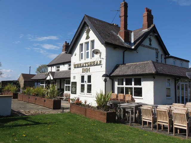
The Wheatsheaf Inn, New York


-
Description
"When the first Ordnance Survey Six-Inch map of the area was published in 1865, Murton West House stood on this site. However, by the time of the 1898 Ordnance Survey map, the 'Wheat Sheaf Inn' was firmly established on this site. For a selection of detailed free to download walking routes in the area visit www.northtynesidewalks.co.uk" Photo by Geoff Holland, 2020. -
Owner
Geoff Holland -
Source
Geograph (Geograph) -
License
What does this mean? Creative Commons License
-
Further information
Link: http://www.geograph.org.uk/photo/6460402
Resource type: Image
Added by: Simon Cotterill
Last modified: 5 years, 7 months ago
Viewed: 726 times
Picture Taken: 2020-05-01 -
Co-Curate tags


