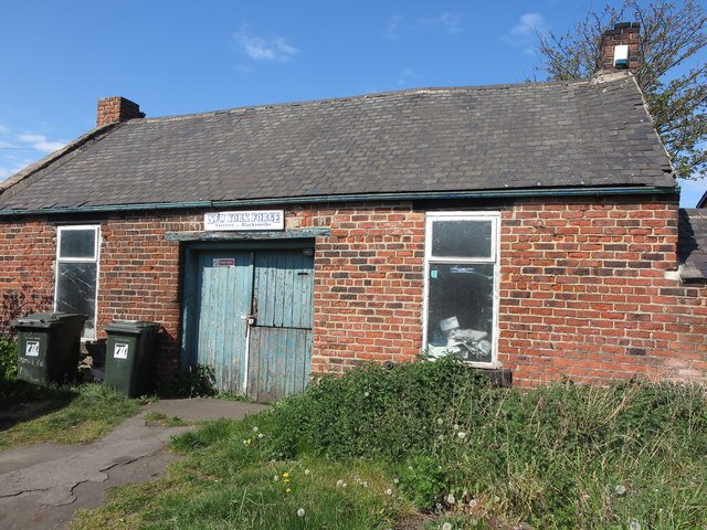
Old Forge (Smithy), Brookland Terrace, New York


-
Description
"It is thought that a forge has stood on this site since the mid-18th century. However, as this point was once an important medieval crossroads linking the monasteries of Lindisfarne and Jarrow, it is conceivable that a forge stood here long before the mid-18th century. When the first Ordnance Survey Six-Inch map of the area was published in 1865, the forge was not named on the map although the adjacent building was referred to as the 'Traveller's Rest (P.H.)'. When the 1898 Ordnance Survey map was published, the public house no longer existed and the only property shown and named on the map at this point was a 'Smithy'. This gives weight to the belief that the current brick building was built at some time between the publication of the two maps. For a selection of detailed free to download walking routes in the area visit www.northtynesidewalks.co.uk" Photo by Geoff Holland, 2020. -
Owner
Geoff Holland -
Source
Geograph (Geograph) -
License
What does this mean? Creative Commons License
-
Further information
Link: http://www.geograph.org.uk/photo/6460385
Resource type: Image
Added by: Simon Cotterill
Last modified: 5 years, 7 months ago
Viewed: 841 times
Picture Taken: 2020-05-01 -
Co-Curate tags


