Birkrigg Common


-
Description
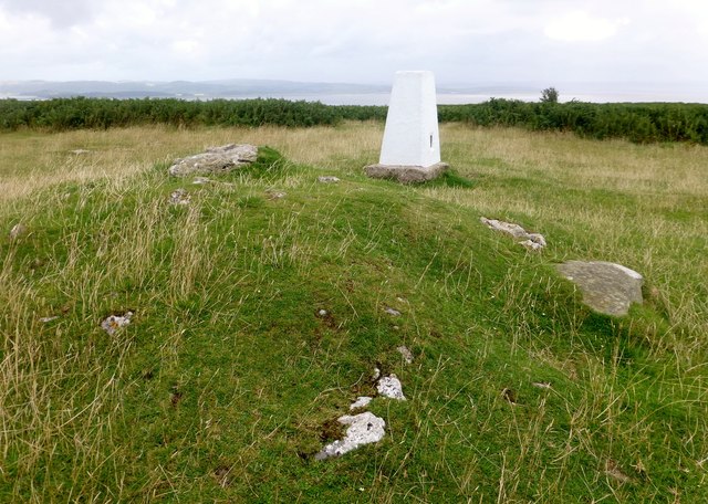
"A lovely viewpoint in limestone country and a trig nearby too. Name: Birkrigg Common Hill number: 16273 Height: 136m / 446ft Parent (Ma/M): 2668 Kirkby Moor [Lowick High Common] Section: 34D: Southern Cumbria County/UA: Cumbria (CoU) Class: Tump (100-199m) Grid ref: SD 28340 74221 Summit feature: rock on grass mound 3m W of trig point Drop: 70m Col: 66m SD271758" Photo by Rude Health , 2014. -
Owner
Rude Health -
Source
Geograph (Geograph) -
License
What does this mean? Creative Commons License
-
Further information
Link: http://www.geograph.org.uk/photo/4602227
Resource type: Image
Added by: Peter Smith
Last modified: 6 years, 5 months ago
Viewed: 652 times
Picture Taken: 2014-08-13 -
Co-Curate tags


