Scots' Dike


-
Description
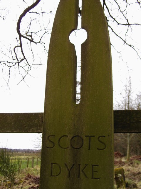
"....The monument includes the earthworks and buried remains of Scots' Dike, a 16th century linear earthwork consisting of banks and ditches, which was constructed to demarcate the border between England and Scotland. The scheduling includes only the earthworks lying to the south of the border. The remains of the dike on the northern side are protected separately under historic monuments legislation for Scotland. The dike originally ran for approximately 5.6km between the rivers Sark and Esk across a tract of land known as the Debateable Land, an area of the borders recognised as one of the most lawless parts of Great Britain for many centuries on account of the constant claims, counterclaims and warfare of its inhabitants. In 1552 Commissioners appointed by Mary, Queen of Scots, and Edward VI met `and agreed on a line to be marked by a ditch and marchstones, the ground to one side whereof was thenceforth to belong to England, and that on the other to belong to Scotland....." -
Owner
Historic England -
Source
Local (Co-Curate) -
License
What does this mean? Unknown license check permission to reuse
-
Further information
Link: https://historicengland.org.uk/listing/the-list/list-entry/1016860
Resource type: Text/Website
Added by: Simon Cotterill
Last modified: 6 years, 8 months ago
Viewed: 631 times
Picture Taken: Unknown -
Co-Curate tags


