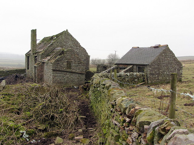
Fellburn near High Ramshaw

  • Description

    "Fellburn was probably originally a farm near High Ramshaw and Low Todhillwood but marked as 'ruins' on the 1st edition OS (1865). Shown as 'school' on the 1896 map and possibly in use up to the 1950s but now ruined again." Photo by Andrew Curtis, 2015.
  • Owner

    Andrew Curtis
  • Source

    Geograph (Geograph)
  • License

    What does this mean? Creative Commons License
  • Further information

    Link: http://www.geograph.org.uk/photo/4363505
    Resource type: Image
    Added by: Simon Cotterill
    Last modified: 4 years, 10 months ago
    Viewed: 489 times
    Picture Taken: 2015-02-13
  • Co-Curate tags

Comments

Add a comment or share a memory.

Login to add a comment. Sign-up if you don't already have an account.

ABOUT US

Co-Curate is a project which brings together online collections, museums, universities, schools and community groups to make and re-make stories and images from North East England and Cumbria. Co-Curate is a trans-disciplinary project that will open up 'official' museum and 'un-officia'l co-created community-based collections and archives through innovative collaborative approaches using social media and open archives/data.

LATEST SHARED RESOURCES