Topics > Civil Parishes in Cumbria > Muncaster Civil Parish > Historic Buildings and Monuments in Muncaster Civil Parish
Historic Buildings and Monuments in Muncaster Civil Parish
Historic buildings and scheduled monuments in Muncaster Civil Parish, Cumbria, from the National Heritage List for England[1]. In the absence of a published 'local list', some other public buildings of interest may also be included. Use the Search (below) if looking for a specific building / monument.
| Structure | List No. | Grade | Built~ | Notes |
|---|---|---|---|---|
| Barn with Adjoining Cottage, Parallel to How Bank Farmhouse | 1336044 | II | 1749 | |
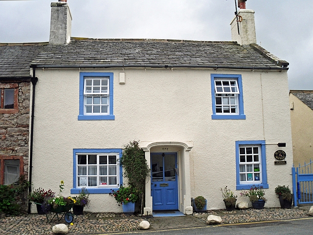
| Bay Horse | 1068807 | II | 1764 | Ravenglass |
| Caddy Tombstone 7 Yards to South of Church Porch | 1356117 | II | 1726 | |
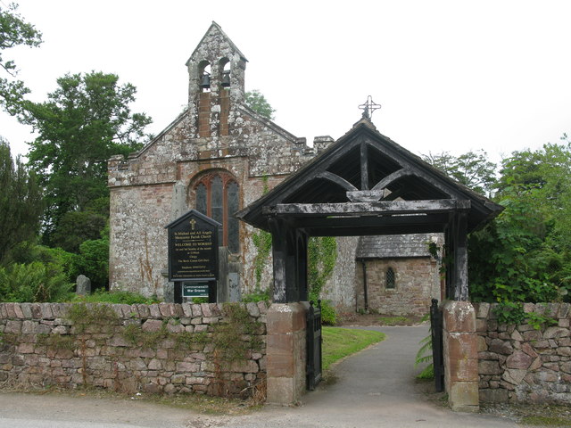
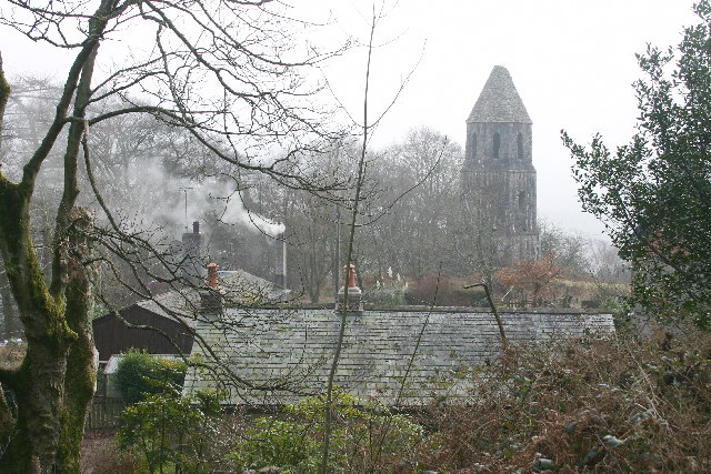
| Church of St Michael and All Angels | 1356113 | I | C16th | Muncaster |
| Cropple How Farmhouse | 1336043 | II | C18th | |
| East Gateway to St Michael and All Angels Churchyard | 1086637 | II | C19th | Muncaster |
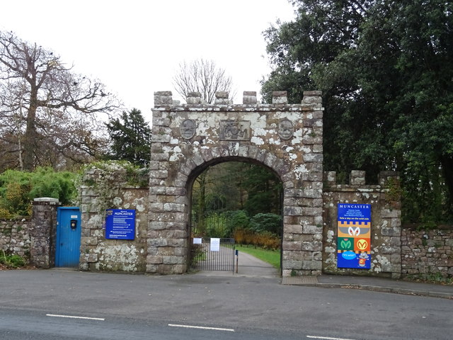
| Entrance Gateway and Walls to North of Muncaster Castle | 1336045 | II | C18th | Muncaster |
| Farm Building Immediately West of Cropple How Farmhouse | 1393157 | II* | C16th | |
| How Bank Farmhouse with Adjoining Barn and Byre | 1086634 | II | C18th | |
| Monument North East of Muncaster Castle | 1068766 | II | C18th | |
| Muncaster Castle | 1068780 | I | C13/18th | Muncaster House incorporating C13th tower |
| Muncaster War Memorial and area wall | 1086636 | II | 1922 | Ravenglass, A595 |
| Pennington House | 1336046 | II | C17th | Ravenglass |
| Yew Tree Cottage | 1086635 | II | 1833 | A595 |
| Muncaster Castle - Grounds | 1000669 | II* | C16th | Listed Park and Garden |
| High cross shaft, high cross head, and high cross base in St Michael and All Angels churchyard | 1012645 | n/a | <C11th | Scheduled Monument |
| Barnscar prehistoric cairnfield, two hut circle settlements, field systems, funerary cairns, and a Romano-British farmstead, trackway and field system | 1019427 | n/a | Prehistoric | Scheduled Monument |
| Prehistoric cairnfield 660m north east of Barnscar settlement | 1019910 | n/a | Prehistoric | Scheduled Monument |
| Roman Kilns | 1007176 | n/a | Roman | Scheduled Monument |
| Ravenglass Roman fort bath-house, also known as Walls Castle | 1009352 | n/a | Roman | Scheduled Monument |
| Ravenglass Roman fort | 1013013 | n/a | Roman | Scheduled Monument |
| Stainton Ling prehistoric hut circle settlement, associated field systems, cairnfields, funerary cairns, and a medieval field system and two shielings | 1016983 | n/a | Prehistoric | Scheduled Monument |
| Prehistoric cairnfield on Stainton Fell, 950m north of Rowantree Force | 1016984 | n/a | Prehistoric | Scheduled Monument |
| Prehistoric cairnfield on Stainton Fell, 660m north of Rowantree Force | 1016985 | n/a | Prehistoric | Scheduled Monument |
| Prehistoric long cairn on Stainton Fell, 940m north east of Rowantree Force | 1016986 | n/a | Prehistoric | Scheduled Monument |
| Prehistoric enclosure south of The Intake, 920m south east of Stainton | 1016987 | n/a | Prehistoric | Scheduled Monument |
| Black Beck North prehistoric cairnfield on Birkby Fell, 950m SSW of the confluence of Linbeck Gill and Black Beck | 1019423 | n/a | Prehistoric | Scheduled Monument |
| Prehistoric cairnfield and enclosure 750m west of Barnscar settlement | 1019424 | n/a | Prehistoric | Scheduled Monument |
| Prehistoric cairnfield 570m south west of Barnscar settlement | 1019425 | n/a | Prehistoric | Scheduled Monument |
| Prehistoric cairnfield, associated field system and a funerary cairn 520m south of Barnscar settlement | 1019426 | n/a | Prehistoric | Scheduled Monument |
| Prehistoric cairnfield and associated field system on Stainton Fell, 760m NNE of Stainton | 1019428 | n/a | Prehistoric | Scheduled Monument |
| Prehistoric cairnfield on Stainton Fell, 540m south west of The Knott | 1019429 | n/a | Prehistoric | Scheduled Monument |
| Prehistoric cairnfield and associated field system on Stainton Fell, 330m south of The Knott | 1019430 | n/a | Prehistoric | Scheduled Monument |
| Prehistoric cairnfield and associated field system 350m west of The Knott | 1019431 | n/a | Prehistoric | Scheduled Monument |
| Prehistoric cairnfield, hut circle settlement, field system, funerary cairn, and a medieval shieling on Birkby Fell west of Devoke Water | 1019551 | n/a | Prehistoric | Scheduled Monument |
| Prehistoric cairnfield on Stainton Fell, 950m north of Rowantree Force | 1016984 | n/a | Prehistoric | Scheduled Monument |
| Prehistoric cairnfield on Birkby Fell, 360m south east of Raven Crag | 1019433 | n/a | Prehistoric | Scheduled Monument |
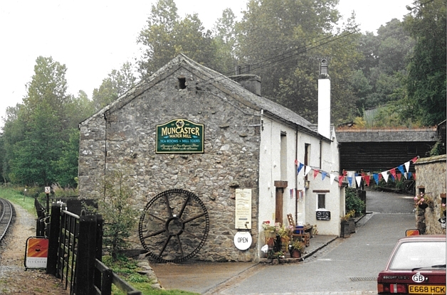
| Muncaster Mill | not listed | n/a | C19th? | Watermill |
| Old School | not listed | n/a | 1876 | Muncaster |
| Ravenglass Conservation Area | - | n/a | Conservation Area |
Primary source: the National Heritage List for England - NHLE is the register of nationally protected historic buildings and sites in England, including listed buildings, scheduled monuments, protected wrecks, registered parks and gardens, and battlefields. The list is maintained by Historic England. Check NHLE for updates and new entries. Secondary sources: British Listed Buildings.
Co-Curate Page
Church of St Michael and All Angels, Muncaster
- Overview About the Church Map Street View Inside The Church of St Michael and All Angels is the parish church of Muncaster. It is located in the grounds of Muncaster …

Co-Curate Page
Muncaster Castle
- Overview Map Street View Muncaster Castle is near Ravenglass in Cumbria; located off the A595 road, about 14 miles south of Whitehaven and 11 miles north of Millom.The site dates …
Co-Curate Page
Bay Horse, Ravenglass
- The Bay Horse is a house in Ravenglass which built in 1764. It is currently a bed and breakfast. The Bay Horse is Grade II listed on the National Heritage …
Co-Curate Page
Muncaster Mill
- Overview Map Street View Muncaster Mill is a former water-powered corn mill, now a private residence, located off the A595 road, about 1 mile north-east of Ravensglass and 1 mile …

Co-Curate Page
Old School, Muncaster
- Overview Map Street View The Old School is located by the A595 road at Muncaster. The school was built in 1876, replacing an earlier school room of 1706, and earlier …
Co-Curate Page
Gateway to Muncaster Castle
- Overview Map Street View The entrance gateway to Muncaster Castle dates from the 18th centry, with 19th century alteratons. The gateway is located by the A595 road at Muncaster. The …

Co-Curate Page
Grounds and Parkland, Muncaster Castle
- The grounds of Muncaster Castle cover 77 acres and are a Grade II* listed Park and Garden on the National Heritage List for England. The gardens include an 18th century …

Co-Curate Page
Muncaster Parish War Memorial
- Overview Map Street View The war memorial for Muncaster Parish is located by the juction of Main Street (east of Ravenglass) with the A595 road. Built in Lakeland granite, the …
Co-Curate Page
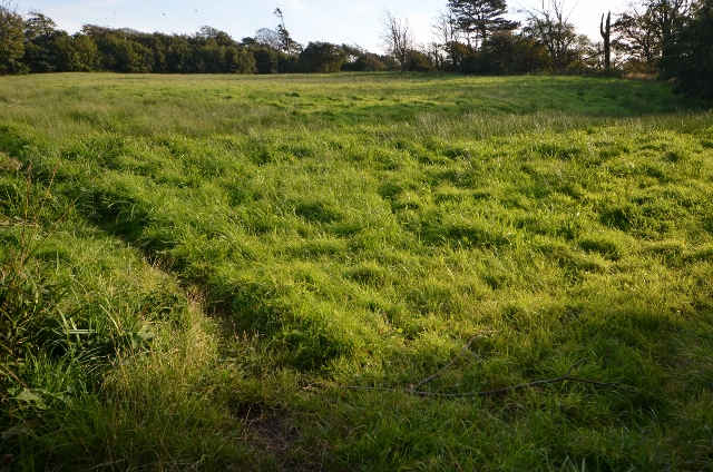
Ravenglass Roman Fort
- % The site of the Roman fort Glannoventa is located to the south of Ravenglass. The burried remains of the fort survive as visible earthworks. The fort served as an …
Co-Curate Page
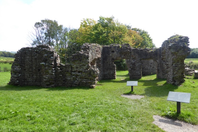
Roman Bath House, Ravenglass
- Overview Map Street View The remains of the bath house of Ravenglass Roman Fort, established around AD 130, are among the tallest Roman structures surviving in northern Britain. The bath …

Co-Curate Page
Roman Tile Kilns, near Birks Coppice
- % The site of two Roman tile kilns is located by Birks Coppice in Eskdale, just over 2 miles north-east of Muncaster. The remains of the kilns were first found …

Co-Curate Page
Church of St Michael and All Angels, Muncaster
- Overview About the Church Map Street View Inside The Church of St Michael and All Angels is the parish church of Muncaster. It is located in the grounds of Muncaster …
Co-Curate Page
Muncaster Castle
- Overview Map Street View Muncaster Castle is near Ravenglass in Cumbria; located off the A595 road, about 14 miles south of Whitehaven and 11 miles north of Millom.The site dates …
Co-Curate Page
Bay Horse, Ravenglass
- The Bay Horse is a house in Ravenglass which built in 1764. It is currently a bed and breakfast. The Bay Horse is Grade II listed on the National Heritage …
Co-Curate Page
Muncaster Mill
- Overview Map Street View Muncaster Mill is a former water-powered corn mill, now a private residence, located off the A595 road, about 1 mile north-east of Ravensglass and 1 mile …
Co-Curate Page
Old School, Muncaster
- Overview Map Street View The Old School is located by the A595 road at Muncaster. The school was built in 1876, replacing an earlier school room of 1706, and earlier …
Co-Curate Page
Gateway to Muncaster Castle
- Overview Map Street View The entrance gateway to Muncaster Castle dates from the 18th centry, with 19th century alteratons. The gateway is located by the A595 road at Muncaster. The …
Co-Curate Page
Grounds and Parkland, Muncaster Castle
- The grounds of Muncaster Castle cover 77 acres and are a Grade II* listed Park and Garden on the National Heritage List for England. The gardens include an 18th century …
Co-Curate Page
Muncaster Parish War Memorial
- Overview Map Street View The war memorial for Muncaster Parish is located by the juction of Main Street (east of Ravenglass) with the A595 road. Built in Lakeland granite, the …
Co-Curate Page
Ravenglass Roman Fort
- % The site of the Roman fort Glannoventa is located to the south of Ravenglass. The burried remains of the fort survive as visible earthworks. The fort served as an …
Co-Curate Page
Roman Bath House, Ravenglass
- Overview Map Street View The remains of the bath house of Ravenglass Roman Fort, established around AD 130, are among the tallest Roman structures surviving in northern Britain. The bath …


