Topics > Civil Parishes in Cumbria > Threlkeld Civil Parish > Historic Buildings and Monuments in Threlkeld Civil Parish
Historic Buildings and Monuments in Threlkeld Civil Parish
Listed buildings and scheduled monuments in Threlkeld Civil Parish, Cumbria, from the National Heritage List for England[1]. Use the Search (below) if looking for a specific building / monument.
| Structure | List No. | Grade | Built~ | Note |
|---|---|---|---|---|
| Barn Adjoining to South West Stoneraise | 1312078 | II | 1866 | |
| Barn East of Birkettfield | 1319021 | II | C18th | |
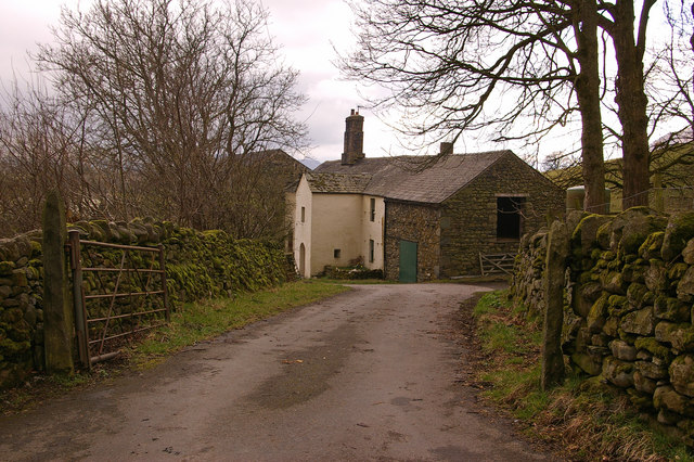
| Birkettfield and Adjoining Former Stable | 1137849 | II | C17th | Former farmhouse |
| Building 35 Metres West of Threlkeld Parish Church | 1319024 | II | C16th | Former house |
| Church of St Mary | 1319022 | II | 1777 | On the site of an earlier church. |
| Derwentfolds and Adjoining Barn | 1312109 | II | C17th | Farmhouse |
| Dobson's Bridge | 1145630 | II | C18th | Over the River Glendermackin |
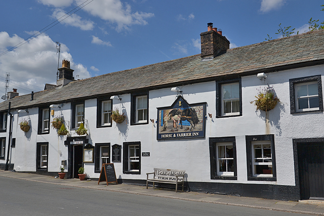
| Horse and Farrier Inn and Adjoining House | 1145632 | II | 1688 | |
| House West of Wesco Farmhouse | 1145633 | II | C18th | Former farmhouse |
| Low House | 1137927 | II | C17th | |
| Stoneraise | 1145631 | II | C17th | Farmhouse |
| The Old Manse and Former Barn | 1137917 | II | 1602 | House, former vicarage |
| The Riddings and Adjoining Barn Wings | 1319023 | II | C18th | Farmhouse |
| Wesco Farmhouse and Adjoining Barns | 1312094 | II | C17th | Farmhouse |
| Prehistoric stone hut circle settlement, irregular aggregate field system,five enclosures,a well,a cairnfield and trackways on St John's and Threlkeld Commons | 1013383 | n/a | Scheduled Monument. Partly in this parish |
Primary source: the National Heritage List for England - NHLE is the register of nationally protected historic buildings and sites in England, including listed buildings, scheduled monuments, protected wrecks, registered parks and gardens, and battlefields. The list is maintained by Historic England. Check NHLE for updates and new entries. Secondary sources: British Listed Buildings.
Co-Curate Page
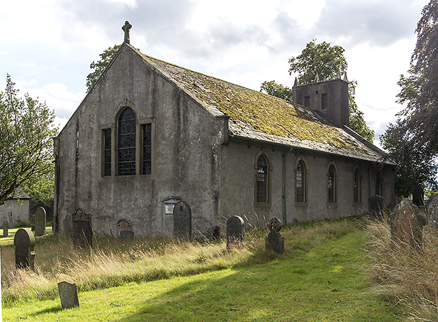
Church of St Mary, Threlkeld
- Overview Map Street View St Mary’s Church in Threlkeld was rebuilt in 1777, incorporating the bell-tower iof an earlier church. There has been a church on this site since at least …
Co-Curate Page
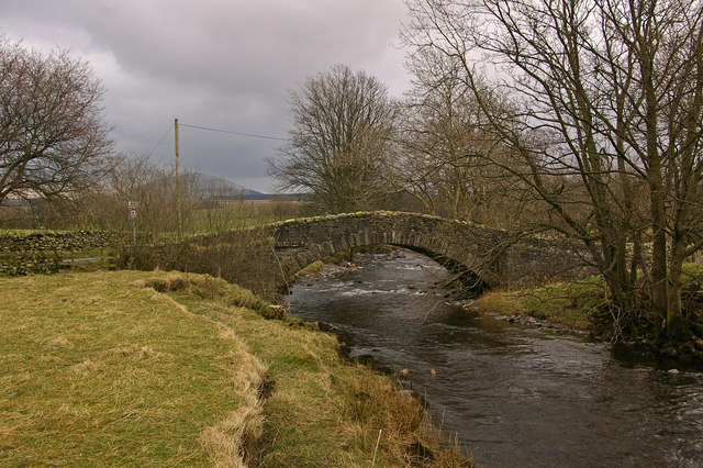
Dobson's Bridge, nr Threlkeld
- Overview Map Street View Dobson's Bridge is a single wide arch roadbridge over the River Glendermackin, located about 1½ miles north-east of Threlkeld and a short distance west of the …
Co-Curate Page
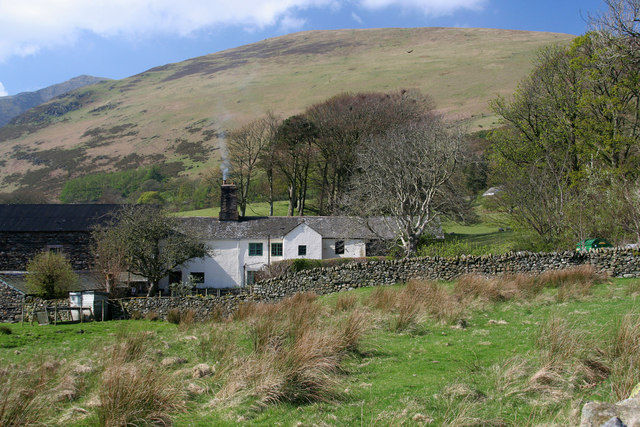
Stoneraise, Threlkeld
- Overview Map Street View Stoneraise is a farm, located about 1½ miles noth-east of the vlllage of Threlkeld in Cumbria. The farmhouse was built in the mid 17th century, with …
Co-Curate Page
Barn adjoining Stoneraise Farmhouse
- Overview Map Street View This large barn, built of coursed Skiddaw slate, is located to the south-west of Stoneraise farmhouse, near Threlkeld. The barn is dated and inscribed "F.M.C.1866." over …

Co-Curate Page
Church of St Mary, Threlkeld
- Overview Map Street View St Mary’s Church in Threlkeld was rebuilt in 1777, incorporating the bell-tower iof an earlier church. There has been a church on this site since at least …
Co-Curate Page
Dobson's Bridge, nr Threlkeld
- Overview Map Street View Dobson's Bridge is a single wide arch roadbridge over the River Glendermackin, located about 1½ miles north-east of Threlkeld and a short distance west of the …
Co-Curate Page
Stoneraise, Threlkeld
- Overview Map Street View Stoneraise is a farm, located about 1½ miles noth-east of the vlllage of Threlkeld in Cumbria. The farmhouse was built in the mid 17th century, with …


