Topics > Civil Parishes in Cumbria > Strickland Ketel Civil Parish > Historic Buildings and Monuments in Strickland Ketel
Historic Buildings and Monuments in Strickland Ketel
Listed buildings and scheduled monuments in Strickland Ketel Civil Parish, Cumbria, from the National Heritage List for England[1]. Use the Search (below) if looking for a specific building / monument.
| Structure | List No. | Grade | Built~ | Note |
|---|---|---|---|---|
| Barbary Crag | 1086607 | II | ||
| Barn 200 Metres South East of Helsfell Farmhouse | 1213008 | II | ||
| Barn Group to South East of Low Brundrigg Farmhouse | 1086565 | II | ||
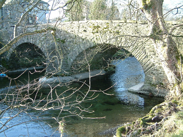
| Bowston Bridge | 1289250 | II | C17th | Bridge over River Kent |
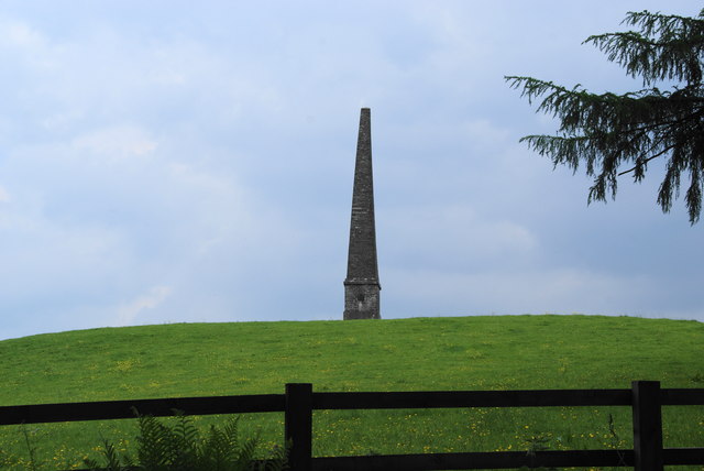
| Elba Monument | 1213003 | II | 1814 | Near Tolson hall |
| Gateway to South of Tolson Hall and Attached Walls | 1213045 | II | c.1800 | Hollins Lane |
| Helsfell Farmhouse | 1086608 | II | ||
| Hollins Farmhouse and Attached Outbuildings | 1289259 | II | ||
| Junction Cottages | 1086567 | II | ||
| Low Brundrigg Farmhouse | 1336070 | II | ||
| Milestone 10 Metres East of Junction of Crook Road and Ratherheath Lane | 1213052 | II | C19th | |
| Milestone in Layby to Left of A591 200 Metres North of Ratherheath Lane | 1086568 | II | ||
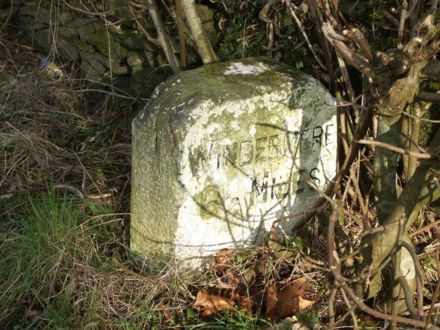
| Milestone on Loop Road 50 Yards South of Junction of Hollins Lane and Windermere | 1213019 | II | C19th | |
| Plumgarths Cottages | 1336090 | II | 1611 | |
| Summerhouse to North of Whitefoot | 1336089 | II | ||
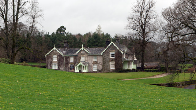
| Tolson Hall | 1086566 | II | 1638 | With later alterations. |
Primary source: the National Heritage List for England - NHLE is the register of nationally protected historic buildings and sites in England, including listed buildings, scheduled monuments, protected wrecks, registered parks and gardens, and battlefields. The list is maintained by Historic England. Check NHLE for updates and new entries. Secondary sources: British Listed Buildings.
Co-Curate Page
Bowston Bridge
- Overview Map Street View The stone bridge over the River Kent at Bowston dates from the 17th century; it was later widened on its North side. The bridge is Grade …
Co-Curate Page
The Elba Monument
- Overview Map Street View The Elba Monument stands on Monument Hill, about ½ mile south-west of Burneside in Cumbria. Built in 1814, the monument is Grade II listed on the …
Co-Curate Page
Old Milestone off Windermere Road, near Burneside
- Overview Map KENDAL 2 MILES WINDERMERE 6½ MILES
Co-Curate Page
Tolson Hall
- Overview Map Street View Tolson Hall is located off Sharpes Lane, about ¼ mile west of Burneside. The Hall was originally built in 1638 for Thomas Tolson, a tobacco merchant. …
Co-Curate Page
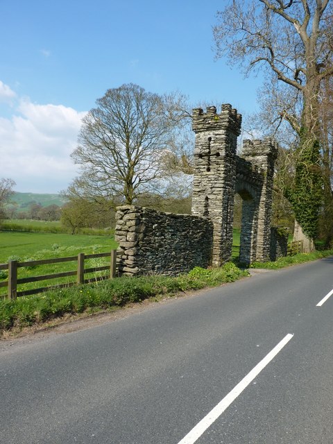
Old Gateway to Tolson Hall
- Overview Map Street View This former gateway to Tolson Hall is located on Hollins Lane, about a ¼ mile west of Burneside. It was built in c.1800 and is Grade …
Co-Curate Page
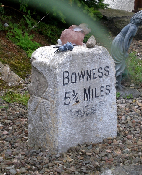
Old Milestone west of Bonning Gate, B5284
- This old milestone is located by the B5284 road near Bonning Gate. It was erected by the Ambleside Turnpike Trust in the 19th century and is Grade II listed on …

Co-Curate Page
Bowston Bridge
- Overview Map Street View The stone bridge over the River Kent at Bowston dates from the 17th century; it was later widened on its North side. The bridge is Grade …
Co-Curate Page
The Elba Monument
- Overview Map Street View The Elba Monument stands on Monument Hill, about ½ mile south-west of Burneside in Cumbria. Built in 1814, the monument is Grade II listed on the …
Co-Curate Page
Old Milestone off Windermere Road, near Burneside
- Overview Map KENDAL 2 MILES WINDERMERE 6½ MILES
Co-Curate Page
Tolson Hall
- Overview Map Street View Tolson Hall is located off Sharpes Lane, about ¼ mile west of Burneside. The Hall was originally built in 1638 for Thomas Tolson, a tobacco merchant. …
Co-Curate Page
Old Gateway to Tolson Hall
- Overview Map Street View This former gateway to Tolson Hall is located on Hollins Lane, about a ¼ mile west of Burneside. It was built in c.1800 and is Grade …


