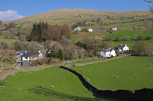
Topics > Civil Parishes in Cumbria > Kentmere Civil Parish > Historic Buildings and Monuments in Kentmere
Historic Buildings and Monuments in Kentmere
Listed buildings and scheduled monuments in Kentmere Civil Parish, Cumbria, from the National Heritage List for England[1]. Use the Search (below) if looking for a specific building / monument.
| Structure | List No. | Grade | Built~ | Note |
|---|---|---|---|---|
| Barn to South of Brockstones Farmhouse at NGR 466052 | 1204245 | II | ||
| Barn to South of Overend Farmhouse at NGR 463057 | 1261951 | II | ||
| Barn to South West of Brockstones Farmhouse at NGR 466052 | 1253126 | II | ||
| Barn to South West of Overend Farmhouse at NGR 463057 | 1086546 | II | ||
| Brockstones Farmhouse | 1086545 | II | ||
| Brow Top Farmhouse | 1204276 | II | ||
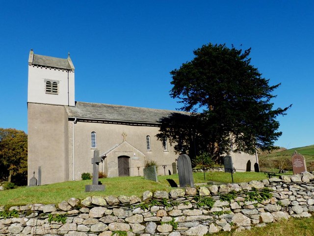
| Church of St Cuthbert | 1336083 | II | C16th | Substantially rebuilt 1866 |
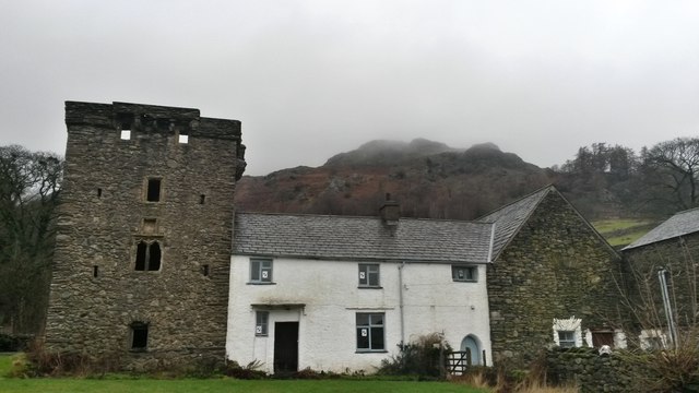
| Kentmere Hall and Attached Barn | 1086547 | II* | C14th | Pele tower with later alterations |
| Limekiln to North West of Kentmere Hall | 1336080 | II | ||
| Longhouses Farmhouse and Attached Shippon | 1336079 | II | ||
| Overend Farmhouse | 1281304 | II | ||
| Rookhowe Farmhouse and Attached, Stable, Byres, Barn and Wc | 1086548 | II | ||
| Scales Farmhouse and Barn | 1379938 | II | ||
| Shippon and Haybarn Adjoining South East Corner Kentmere Hall | 1204269 | II | ||
| Millrigg Romano-British enclosed hut circle settlement | 1008898 | n/a | Scheduled Monument | |
| Romano-British enclosed stone hut circle settlement and Romano-British farmstead north west of Tongue House Barn. | 1008899 | n/a | Scheduled Monument | |
| High Street, Roman road | 1003275 | n/a | Scheduled Monument. Partly in this parish. |
Primary source: the National Heritage List for England - NHLE is the register of nationally protected historic buildings and sites in England, including listed buildings, scheduled monuments, protected wrecks, registered parks and gardens, and battlefields. The list is maintained by Historic England. Check NHLE for updates and new entries. Secondary sources: British Listed Buildings.
Co-Curate Page
Church of St Cuthbert, Kentmere
- Overview About St Cuthbert's Church Map Street View Inside St Cuthbert's is the Parish Church in Kentmere. The church dates from the 16th century, though it was substantially rebuilt in …
Co-Curate Page
Kentmere Hall
- Overview Map Street View Kentmere Hall (now known as Pele Tower House) is located in the Kentmere valley to the west of St Cuthbert's Church. The pele tower dates from …

Co-Curate Page
Church of St Cuthbert, Kentmere
- Overview About St Cuthbert's Church Map Street View Inside St Cuthbert's is the Parish Church in Kentmere. The church dates from the 16th century, though it was substantially rebuilt in …