Topics > Civil Parishes in Cumbria > Holme St. Cuthbert Civil Parish > Historic Buildings and Monuments in Holme St Cuthbert
Historic Buildings and Monuments in Holme St Cuthbert
Listed buildings and scheduled monuments in Holme St Cuthbert Civil Parish, Cumbria, from the National Heritage List for England[1]. In the absence of a published 'local list', some other public buildings of interest may also be included. Use the Search (below) if looking for a specific building / monument.
| Structure | List No. | Grade | Built~ | Note |
|---|---|---|---|---|
| Farmhouse North of Midtown Farmhouse | 1217059 | II | 1686 | Newton |
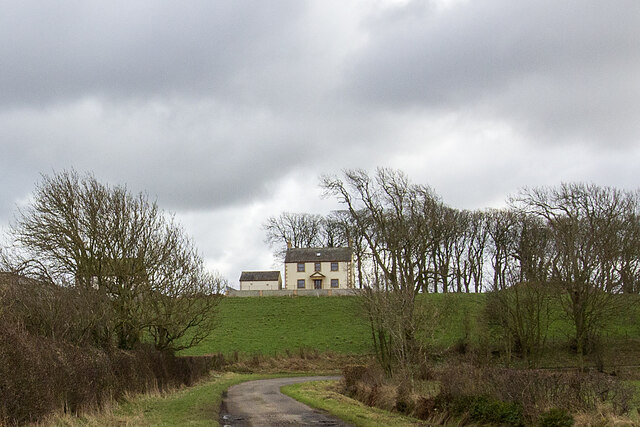
| Lowsay Farmhouse | 1217056 | II | C19th | |
| Manor House | 1217053 | II | 1739 | Edderside. Now Neville House |
| Methodist Chapel | 1275600 | II | 1843 | Mawbray. Now a house. |
| New Cowper Farmhouse and Adjoining Barn | 1217058 | II | C17th | |
| New House | 1275601 | II | C18th | Wolsty |
| Orchard House | 1217057 | II | 1772 | Mawbray |
| Ostle House | 1275599 | II | 1764 | Mawbray |
| West End Farmhouse and Adjoining Former Stable | 1275720 | II | C18th | Edderside |
| Beckfoot Roman fort | 1007170 | n/a | Roman | Scheduled Monument |
| Roman fortlet 40m SSW of Castle Fields | 1007171 | n/a | Roman | Scheduled Monument |
| Oval enclosure 120m N of Brownrigg Hall | 1007191 | n/a | Scheduled Monument | |
| Enclosure 125m SE of Old Mawbray | 1007211 | n/a | Scheduled Monument | |
| Enclosure 105m SE of Old Mawbray | 1007251 | n/a | Scheduled Monument | |
| Enclosure 130m SSE of Old Mawbray | 1003052 | n/a | Scheduled Monument | |
| Romano-British farmstead 250m ENE of Belmont House | 1013506 | n/a | Romano-British | Scheduled Monument |
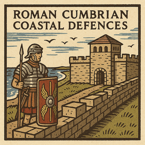
| Dubmill Point milefortlet 17, 560m WNW of Hill House, part of the Roman frontier defences along the Cumbrian coast | 1014803 | n/a | Roman | Scheduled Monument |
| Wolsty South tower 13b, 200m WNW of New House, part of the Roman frontier defences along the Cumbrian coast | 1014807 | n/a | Roman | Scheduled Monument |
| Bank Mill tower 15a, 250m north west of Belmont House, part of the Roman frontier defences along the Cumbrian coast | 1014808 | n/a | Roman | Scheduled Monument |
| Mawbray Sandpit tower 16b, 680m WSW of Hailforth, part of the Roman frontier defences along the Cumbrian coast | 1014809 | n/a | Roman | Scheduled Monument |
| Enclosure 1/2 mile (800m) S of Wolsty | 1007252 | n/a | Scheduled Monument | |
| Church of St Cuthbert | not listed | n/a | 1845 | Holme St Cuthbert |
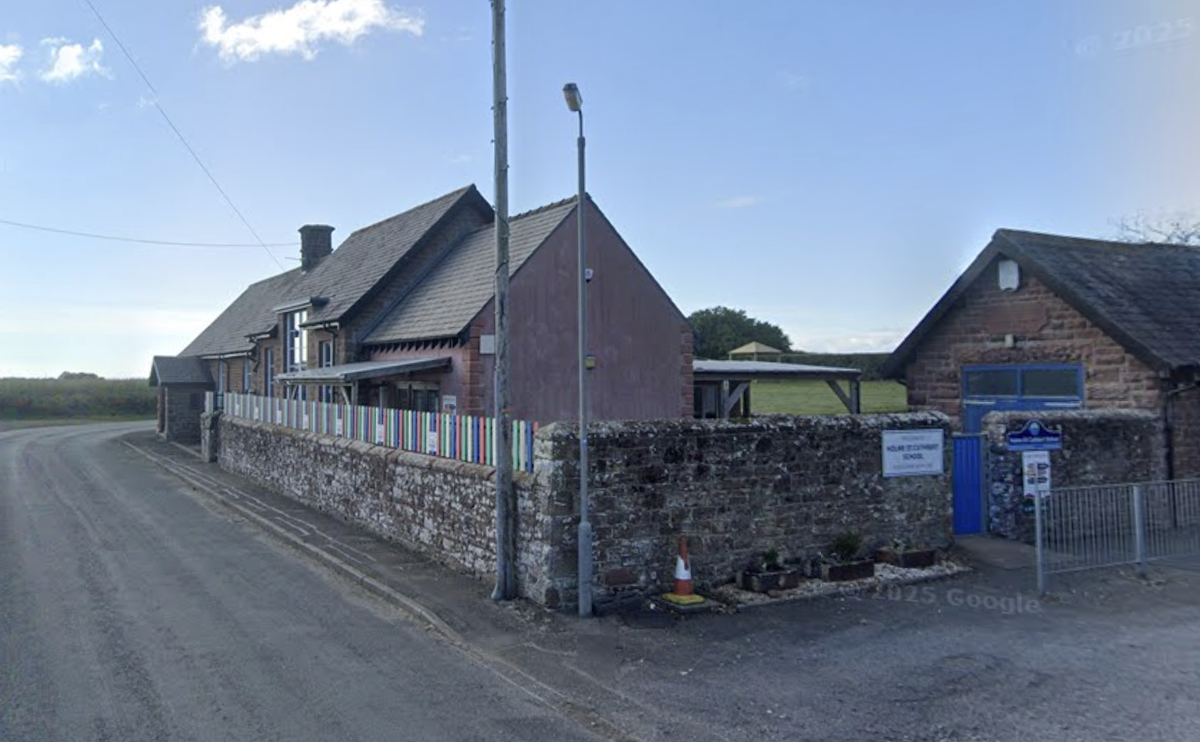
| Holme St Cuthbert School | not listed | n/a | 1845 | Holme St Cuthbert |
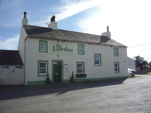
| The Lowther Arms | not listed | n/a | C19th | Mawbray |
| Mawbray Conservation Area | - | n/a | Conservation Area |
Primary source: the National Heritage List for England - NHLE is the register of nationally protected historic buildings and sites in England, including listed buildings, scheduled monuments, protected wrecks, registered parks and gardens, and battlefields. The list is maintained by Historic England. Check NHLE for updates and new entries. Secondary sources: British Listed Buildings.
Co-Curate Page
Milefortlet 17 (Dubmill Point)
- % The burried remains of Milefort 17 on the Roman Cumbrian Coastal Defences are located on the western of two low parallel ridges of raised beach at Dubmill Point, about …

Co-Curate Page
Former Methodist Chapel, Mawbray
- Overview Map Street View This former Methodist Chapel, now a private residence, is located in Mawbray. It was originally built in 1843 as a Wesleyan Methodist Chapel. In 1991 it …

Co-Curate Page
Church of St. Cuthbert, Holme St. Cuthbert
- Overview Map Street View The Gothic style parish church at Holme St Cuthbert was built in 1845. It was initially a chapel of ease to St Mary's at Cultram Abbey. …
Co-Curate Page
Holme St Cuthbert School
- Overview Map Street View Holme St Cuthbert School is a community primary school, located in Holme St Cuthbert, about 1 mile west of Mawbray. The school has about 30 pupils …
Co-Curate Page
Lowsay Farm
- Overview Map Street View Lowsay is a farm in Cumbria, located about 2½ miles south of Siloth and 2 miles north-east of the village of Mawbray. The farmhouse dates from …
Co-Curate Page
The Lowther Arms, Mawbray
- Overview Map Street View The Lowther Arms is a public house in Mawbray, Cumbria. The first record of the pub was in the 1847 Cumberland Directory. It is now a …
Co-Curate Page
Beckfoot Roman Fort
- The site of Beckfoot Roman Fort (Bibra) is located on the Solway Firth coast, about ½ mile south of the hamlet of Beckford. It formed part of the Roman Cumbrian …

Co-Curate Page
Milefortlet 17 (Dubmill Point)
- % The burried remains of Milefort 17 on the Roman Cumbrian Coastal Defences are located on the western of two low parallel ridges of raised beach at Dubmill Point, about …
Co-Curate Page
Former Methodist Chapel, Mawbray
- Overview Map Street View This former Methodist Chapel, now a private residence, is located in Mawbray. It was originally built in 1843 as a Wesleyan Methodist Chapel. In 1991 it …
Co-Curate Page
Church of St. Cuthbert, Holme St. Cuthbert
- Overview Map Street View The Gothic style parish church at Holme St Cuthbert was built in 1845. It was initially a chapel of ease to St Mary's at Cultram Abbey. …
Co-Curate Page
Holme St Cuthbert School
- Overview Map Street View Holme St Cuthbert School is a community primary school, located in Holme St Cuthbert, about 1 mile west of Mawbray. The school has about 30 pupils …
Co-Curate Page
Lowsay Farm
- Overview Map Street View Lowsay is a farm in Cumbria, located about 2½ miles south of Siloth and 2 miles north-east of the village of Mawbray. The farmhouse dates from …
Co-Curate Page
The Lowther Arms, Mawbray
- Overview Map Street View The Lowther Arms is a public house in Mawbray, Cumbria. The first record of the pub was in the 1847 Cumberland Directory. It is now a …


