Topics > Civil Parishes in Cumbria > Firbank Civil Parish, South Lakeland > Historic Buildings and Monuments in Firbank Civil Parish
Historic Buildings and Monuments in Firbank Civil Parish
Listed buildings and scheduled monuments in Firbank Civil Parish, Cumbria, from the National Heritage List for England[1]. Use the Search (below) if looking for a specific building / monument.
| Structure | List No. | Grade | Built~ | Note |
|---|---|---|---|---|
| Lune Viaduct at Newbys Dub | 1086911 | II* | 1861 | Partly in this parish. |
| Lincolns Inn Bridge over the River Lune | 1384063 | II | C17th | Road bridge. Partly in this parish. |
| Barn to East of Underknotts | 1335901 | II | ||
| Bridge End and Attached Barn | 1312178 | II | ||
| Church of St John | 1086913 | II | 1842 | |
| Cottage to North of Moors Farmhouse | 1137739 | II | ||
| Graveyard Boundary Walls to Original Parish Church | 1086914 | II | ||
| Hawkrigg and Adjoining Outbuildings | 1137710 | II | ||
| High House Farmhouse | 1335900 | II | ||
| Lowgill Viaduct | 1086909 | II | 1859 | |
| Milepost Approx 100m West of Bridge End | 1086910 | II | ||
| Milestone at SD 617 961 | 1312190 | II | ||
| Milestone at SD 624 947 | 1086912 | II | ||
| Milestone at SD 628 933 | 1312169 | II | ||
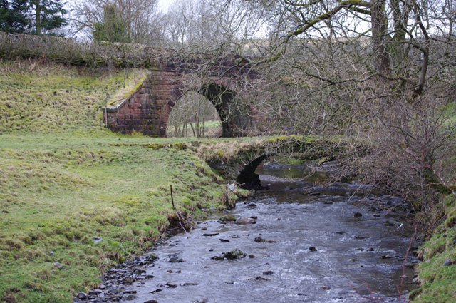
| Packhorse Bridge to West of Lowgill Viaduct | 1137685 | II | C17th | |
| Underknotts | 1312161 | II |
Primary source: the National Heritage List for England - NHLE is the register of nationally protected historic buildings and sites in England, including listed buildings, scheduled monuments, protected wrecks, registered parks and gardens, and battlefields. The list is maintained by Historic England. Check NHLE for updates and new entries. Secondary sources: British Listed Buildings.
Co-Curate Page
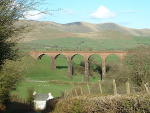
Lowgill Viaduct
- Overview Map Street View Lowgill Viaduct was built in 1859 by Joseph Locke and John Errington for the Ingleton Branch Line of the London and North Western Railway.[1] The 11 …
Co-Curate Page
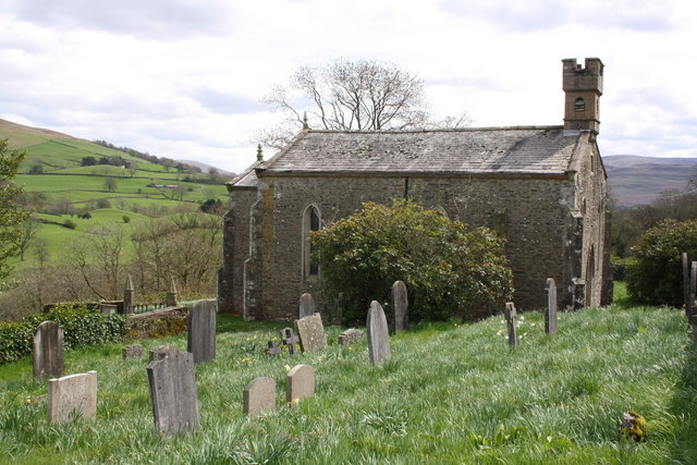
Church of St John the Evangelist, Firbank
- Overview Map Street View Inside St John the Evangelist's Church is located on the B6257 road, to the south of Firbank in Cumbria. The church dates from 1842, built on …
Co-Curate Page
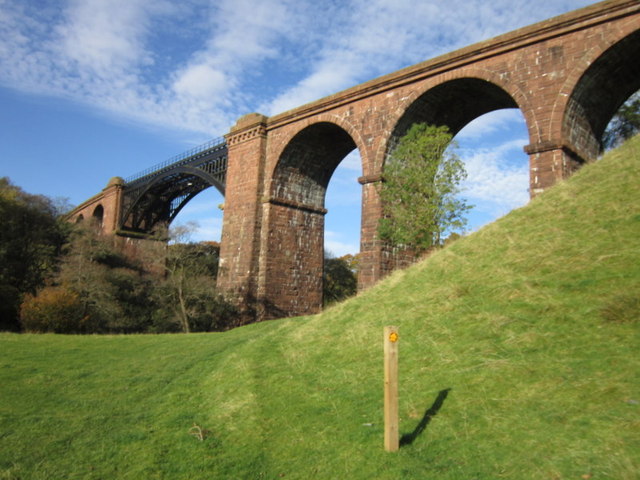
Lune Viaduct at Newbys Dub
- Overview Map Street View The Lune Viaduct at Newbys Dub is located near the hamlet of Waterside and about 1½ miles north-west of Sedbergh. It was built to carry the …

Co-Curate Page
Lowgill Viaduct
- Overview Map Street View Lowgill Viaduct was built in 1859 by Joseph Locke and John Errington for the Ingleton Branch Line of the London and North Western Railway.[1] The 11 …
Co-Curate Page
Church of St John the Evangelist, Firbank
- Overview Map Street View Inside St John the Evangelist's Church is located on the B6257 road, to the south of Firbank in Cumbria. The church dates from 1842, built on …


