Topics > Civil Parishes in Cumbria > Crosby Ravensworth Civil Parish > Historic Buildings and Monuments in Crosby Ravensworth Civil Parish
Historic Buildings and Monuments in Crosby Ravensworth Civil Parish
Listed buildings and scheduled monuments in Crosby Ravensworth Civil Parish, Northumberland, from the National Heritage List for England[1]. Use the Search (below) if looking for a specific building / monument.
| Structure | List No. | Grade | Built~ | Notes |
|---|---|---|---|---|
| 2 Summer Houses on Bowling Green Immediately to South of Maulds Meaburn Hall | 1145420 | II* | ||
| Bank Barn and Byre Range Circa 40 Yards South West of Gilts Farmhouse | 1138086 | II | ||
| Barn and Byre Ranges Adjoining South End of Ploverigg Farmhouse | 1145439 | II | ||
| Barn, Byre and Storage Ranges Around Courtyard (Excepting Coach House, Stable and Tack Room at South | 1145415 | II | ||
| Barn/Byre Range on Roadside Circa 30 Yards North of Gilts Farmhouse | 1145438 | II | ||
| Barnskew Farmhouse with Byre and Barn Ranges Adjoining | 1138066 | II | ||
| Britannia Monument and Enclosure Walls to North of Shap Wells Hotel (At NGR NY 579 098) | 1145422 | II | ||
| Charles II Monument at Source of the River Lyvennet (At NGR 604 108) | 1145440 | II | 1851 | On Crosby Ravenswoth Fell |
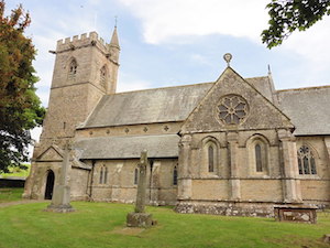
| Church of St Lawrence | 1311870 | I | C13th | Crosby Ravensworth |
| Coach House, Stable and Tack Room at South West Corner of Group of Outbuildings Arranged Round Court | 1145416 | II | ||
| Coal Storage and Cascade Built Under Driveway Immediately to North of Entrance to Flass House | 1326727 | II | ||
| Crake Trees (Tower House) | 1145437 | II | ||
| Crosby Ravensworth Hall | 1311894 | II | ||
| Cross Stump in St Lawrence's Churchyard to South of Transept | 1145446 | II | ||
| Dent Tombs and Railed Enclosures in St Lawrence's Churchyard to South West of Chancel | 1146354 | II | ||
| Drive Gate Piers Circa 50 Yards North of Flass House | 1326728 | II | ||
| Dryevers Farmhouse with Adjoining Coach House, Forecourt Walls, Railings, and Gate | 1326742 | II | ||
| East Farmhouse with Adjoining Barn Range and Pigsty | 1145442 | II | ||
| Fell Gate Farmhouse and Adjoining Garage | 1138317 | II | ||
| Flass House | 1145414 | II* | ||
| Footbridge over Dalesbank Beck to South of Church | 1326745 | II | ||
| Footbridge over Lyvennnet Beck Circa 160 Yards North of Flass House | 1311791 | II | ||
| Garden Structure 50 Metres South of Yew Tree Farmhouse | 1244288 | II | ||
| Garden Structure South East of Yew Tree Farmhouse | 1244312 | II | ||
| Garden Walls and Gatepiers to Front of Maulds Meaburn Hall | 1157873 | II* | ||
| Gibson Memorial and Railed Enclosure in St Lawrence's Churchyard to East of Chancel | 1145447 | II | ||
| Gilts Farmhouse | 1326739 | II | ||
| Hearse House in St Lawrence's Churchyard to North East of Chancel | 1145412 | II | ||
| Holesfoot House | 1145441 | II* | ||
| Jenny Well House with Adjoining Barn | 1145445 | II | ||
| Littlebeck Cottage Cottage with Byre Adjoining | 1145413 | II | ||
| Maulds Meaburn Hall | 1326730 | II* | ||
| Meaburn Hill Farmhouse | 1145418 | II | ||
| Meaburn Lodge | 1311797 | II | ||
| Monks' Bridge House | 1138296 | II | ||
| Monks' Bridge over the River Lyvennet | 1145444 | II | ||
| Oddendale (Middle House in Settlement) with Adjoining Barns | 1326731 | II | ||
| Oddendale Hall (Eastern House in Settlement) with Adjoining Byre | 1157896 | II | ||
| Oddendale Old Hall (Western House in Settlement) with Adjoining Cart Shed | 1311728 | II | ||
| Parish Boundary Stone | 1326765 | II | ||
| Ploverigg Farmhouse | 1326740 | II | ||
| Ravens' Seat Farmhouse with Adjoining Barn Range and Cart Shed | 1326744 | II | ||
| Reagill Grange | 1157943 | II* | ||
| Roadbridge over Dalesbank Beck to South East of Church | 1326743 | II | ||
| School House with Adjoining Barn and Byre | 1146525 | II | ||
| Smithy Circa 10 Yards South East of the Forge House | 1326729 | II | ||
| Spa Well Pavilion and Pump Head to North West of Shap Wells Hotel (At NGR NY 578 097) | 1157962 | II | ||
| The Green | 1145419 | II | ||
| Trainlands Farmhouse with Adjoining Byre | 1326741 | II | ||
| Village Hall | 1145421 | II | ||
| Well Head Circa 150 Yards North of Flass House | 1145417 | II | ||
| West Farmhouse with Barn and Byre Ranges Adjoining Either End | 1145443 | II | ||
| Yew Tree Farmhouse, attached outbuildings, garden walls and sculptures | 1244311 | II | ||
| Crosby Ravensworth churchyard cross | 1007599 | n/a | Scheduled Monument | |
| Medieval dyke: part of deer park boundary at Crosby Gill | 1007598 | n/a | Scheduled Monument | |
| Round cairn 30m east of Wicker Street Roman Road | 1011512 | n/a | Scheduled Monument | |
| Medieval dyke: part of deer park boundary west of Cow Green | 1007593 | n/a | Scheduled Monument | |
| Medieval dyke: part of deer park boundary at Hollins Scar | 1008145 | n/a | Scheduled Monument | |
| Medieval dyke: part of deer park boundary at Cow Green and two medieval shielings | 1007594 | n/a | Scheduled Monument | |
| Medieval dyke: part of deer park boundary south of Cow Green | 1007595 | n/a | Scheduled Monument | |
| Medieval dyke: part of deer park boundary north of Cow Green | 1007606 | n/a | Scheduled Monument | |
| Medieval dyke: part of deer park boundary on Hazel Moor and two medieval shielings | 1007597 | n/a | Scheduled Monument | |
| Medieval shieling south of Cow Green | 1007596 | n/a | Scheduled Monument | |
| Romano-British enclosed stone hut circle settlement and associated field system on Wickerslack Moor | 1007576 | n/a | Scheduled Monument | |
| Bowl barrow on Wickerslack Moor | 1007577 | n/a | Scheduled Monument | |
| Romano-British settlement and Romano-British farmstead north-east and east of Gilts | 1007578 | n/a | Scheduled Monument | |
| Lyvennet bowl barrow | 1007579 | n/a | Scheduled Monument | |
| Round cairn 300m west of Lyvennet Beck | 1007580 | n/a | Scheduled Monument | |
| Cow Green long barrow | 1007581 | n/a | Scheduled Monument | |
| Burwens Romano-British settlement and associated field system | 1007582 | n/a | Scheduled Monument | |
| Cow Green Romano-British settlement and medieval shieling | 1007583 | n/a | Scheduled Monument | |
| Round cairn 600m south-east of Gaythorne Cottages | 1007584 | n/a | Scheduled Monument | |
| Round cairn 690m south-east of Gaythorne Cottages | 1007585 | n/a | Scheduled Monument | |
| Raise Howe cairn | 1007586 | n/a | Scheduled Monument | |
| Round cairn on Dale Moor | 1007587 | n/a | Scheduled Monument | |
| Bowl barrow 70m west of Lyvennet Beck | 1007588 | n/a | Scheduled Monument | |
| Ewe Close Romano-British enclosed and unenclosed stone hut circle settlements and associated field system, medieval farmstead and Wicker Street Roman road | 1007589 | n/a | Scheduled Monument | |
| Ewe Locks Romano-British settlement, Romano-British farmstead and two medieval shielings | 1007590 | n/a | Scheduled Monument | |
| Three bowl barrows east of Ravens' Gill | 1007602 | n/a | Scheduled Monument | |
| Bowl barrow 20m east of Ravens' Gill | 1007603 | n/a | Scheduled Monument | |
| Bowl barrow 25m east of Ravens' Gill | 1007604 | n/a | Scheduled Monument | |
| Crake Trees tower house | 1007607 | n/a | Scheduled Monument | |
| Round cairn 35m east of summit of Long Scar Pike | 1008560 | n/a | Scheduled Monument | |
| Bowl barrow 40m north-north-east of High Haber | 1008660 | n/a | Scheduled Monument | |
| Round cairn 670m north-east of summit of Long Scar Pike | 1015970 | n/a | Scheduled Monument | |
| Round cairn on Howenook Pike | 1015971 | n/a | Scheduled Monument | |
| Maulds Meaburn medieval settlement, part of its associated medieval open field system and a mill race | 1018934 | n/a | Scheduled Monument | |
| Ravens Gill Romano-British farmstead | 1011510 | n/a | Scheduled Monument | |
| Bowl barrow 230m north-west of Gilts | 1011511 | n/a | Scheduled Monument | |
| Oddendale concentric stone circle | 1011513 | n/a | Scheduled Monument | |
| Bowl barrow 70m south of Iron Hill | 1011517 | n/a | Scheduled Monument | |
| Bowl barrow on Iron Hill | 1011572 | n/a | Scheduled Monument | |
| Round cairn 320m north-north-west of Seal Howe | 1011617 | n/a | Scheduled Monument | |
| Howarcles Romano-British settlement | 1011625 | n/a | Scheduled Monument | |
| Small stone circle on White Hag | 1011626 | n/a | Scheduled Monument | |
| Small stone circle 220m south-east of Castlehowe Scar | 1011610 | n/a | Scheduled Monument | |
| Maulds Meaburn Conservation Area | - | n/a | Conservation Area | |
| Crosby Ravensworth Conservation Area | - | n/a | Conservation Area |
Primary source: the National Heritage List for England - NHLE is the register of nationally protected historic buildings and sites in England, including listed buildings, scheduled monuments, protected wrecks, registered parks and gardens, and battlefields. The list is maintained by Historic England. Check NHLE for updates and new entries. Secondary sources: British Listed Buildings.
Co-Curate Page
Church of St Lawrence, Crosby Ravensworth
- Overview About St Lawrence's Church Map Street View St Lawrence's Church is in the village of Crosby Ravensworth, Cumbria, England. It is an active Anglican parish church in the …


