Topics > Civil Parishes in Cumbria > Broughton West Civil Parish > Historic Buildings and Monuments in Broughton West CP
Historic Buildings and Monuments in Broughton West CP
Listed buildings and scheduled monuments in Broughton West Civil Parish, Cumbria, from the National Heritage List for England[1]. In the absence of a published 'local list', some other public buildings of interest may also be included. Use the Search (below) if looking for a specific building / monument.
| Structure | List No. | Grade | Built~ | Note |
|---|---|---|---|---|
| Nos. 1-5, the Square | 1335976 | II | ||
| Angerton Farmhouse and Barn | 1138019 | II | C17th | Angerton |
| Atkinson Monument Approximately 10.5 Metres to South of St Mary's Church | 1086820 | II | 1805 | Churchyard, St Mary's |
| Barn Opposite of Low Rosthwaite Farmhouse | 1335950 | II | ||
| Beswick's Restaurant and Cafe | 1086824 | II | ||
| Black Cock Inn | 1138217 | II | C17th | Broughton-in-Furness, Princess Street |
| Blacksmiths Arms Public House | 1335972 | II | 1748 | Broughton Mills |
| Broughton House | 1086821 | II | ||
| Broughton Tower Special School | 1335949 | II* | C18th | with C14th Pele Tower. Now Flats. |
| Church of St Mary Magdalene | 1086818 | II | C12th | Broughton-in-Furness, Church Street |
| Cobblers Cottage and Former Broughton Craft Shop | 1138199 | II | ||
| Cottage and Farm Buildings Opposite Syke House | 1086817 | II | ||
| Crag Cottage | 1086813 | II | ||
| Duddon Bridge | 1356555 | II | ||
| Gate and Gate Piers Approximately 67 Metres to North of Broughton Tower | 1312025 | II | ||
| Gateway to Broughton Tower | 1138268 | II | ||
| Group of 4 Tombs Approximately 14 Metres to South of St Mary's Church | 1311974 | II | Churchyard, St Mary's | |
| Grovelands and Adjoining House | 1311933 | II | ||
| Hawes Farmhouse and Outbuildings | 1086849 | II | ||
| Hawk Bridge (That Part in Broughton West) | 1312026 | II | ||
| Lane End Cottage and Barn | 1086815 | II | ||
| Lane End Farmhouse and Barn | 1335974 | II | ||
| Limekiln to South West of Crag Cottage | 1335973 | II | ||
| Low Rosthwaite Farmhouse | 1138051 | II | ||
| Lower Bleansley | 1086850 | II | ||
| Lumholme and Adjoining Barn Range | 1086814 | II | ||
| Market Hall | 1138235 | II | ||
| Obelisk and Stocks | 1086822 | II* | 1810 | Broughton-in-Furness, The Square. |
| Old King's Head Public House | 1138289 | II | C18th | Broughton-in-Furness, Station Road |
| Sand Gap Farmhouse | 1335951 | II | ||
| Shop Bridge and Boundary Stone | 1086852 | II | C18th | Broughton Mills |
| Sundial Approximately 13.5 Metres to South of St Mary's Church | 1086819 | II | Churchyard, St Mary's | |
| Syke House and Syke House Cottage | 1086816 | II | ||
| Terrace of 7 Houses and Manor Arms Public House (Deleted 14/6/68) | 1311902 | II | c.1760 | Broughton-in-Furness, The Square |
| Terrace of Six Houses | 1086825 | II | ||
| The Square Cafe, Hillside and Aitken House | 1335975 | II | ||
| Town End Farmhouse and Outbuildings | 1086851 | II | ||
| Two Market Benches to East of Obelisk | 1086823 | II | ||
| Water Yeat Bridge | 1138062 | II | ||
| Wreaks Causeway End Bridge | 1138084 | II | ||
| Settlement on The Hawk | 1007204 | n/a | Scheduled Monument | |
| War Memorial | not listed | n/a | 1921 | Churchyard, St Mary's |
Primary source: the National Heritage List for England - NHLE is the register of nationally protected historic buildings and sites in England, including listed buildings, scheduled monuments, protected wrecks, registered parks and gardens, and battlefields. The list is maintained by Historic England. Check NHLE for updates and new entries. Secondary sources: British Listed Buildings.
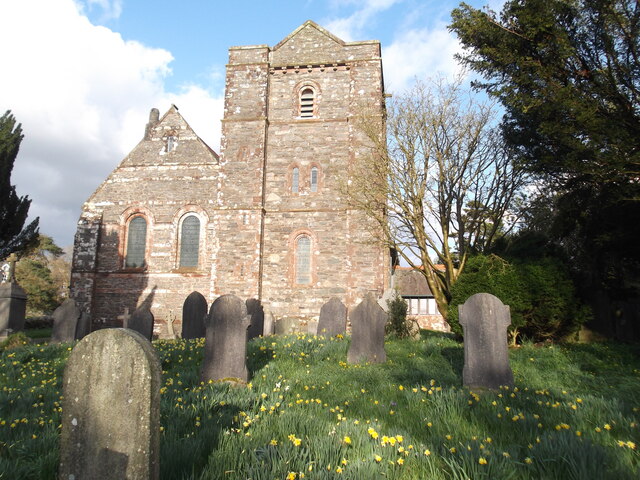
Co-Curate Page
Church of St Mary Magdalene, Broughton-in-Furness
- The Church of St Mary Magdalene in Broughton-in-Furness dates from the 12th century. It has a Medieval south aisle, formerly nave and chancel, with C12th south entrance. C16th and C19th …
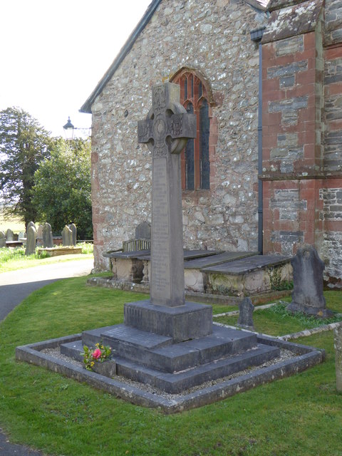
Co-Curate Page
War Memorial, Broughton-in-Furness
- The War Memorial in Broughton-in-Furness is located outside of the Church of Mary Magdalene. The memorial was unveiled on the 3rd April 1921 in a service attended by Mr G.H. …
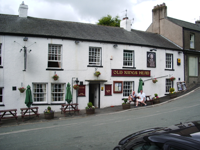
Co-Curate Page
Old Kings Head, Broughton in Furness
- Overview Map Street View The Old Kings Head is an inn located on Station Road in Broughton-in-Furness. The building was first mentioned as Church House in 1666, but was likely …

Co-Curate Page
Obelisk and Stocks, Broughton-in-Furness
- Overview Map Street View The stone obelisk in The Square is a prominent focal point in Broughton-in-Furness. The obelisk was erected in 1810 to celebrate the Golden Jubilee of King …
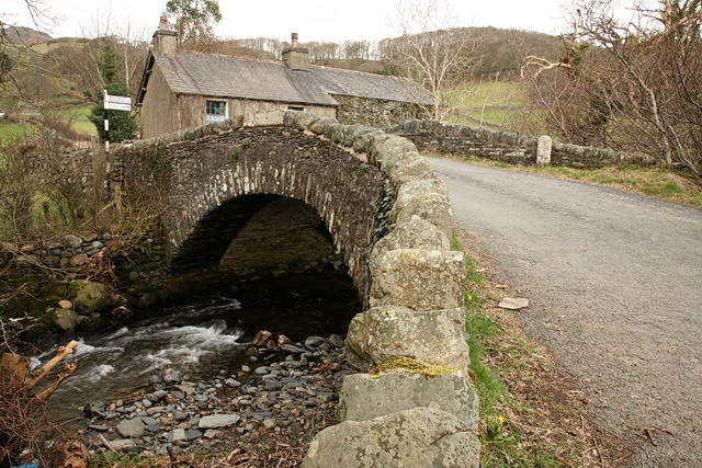
Co-Curate Page
Shop Bridge and Boundary Stone, Broughton Mills
- Overview Map Street View Shop Bridge is a stone road bridge over the River Lickle at Broughton Mills. The segmental arched bridge dates from the 18th century, with later widening. …
Co-Curate Page
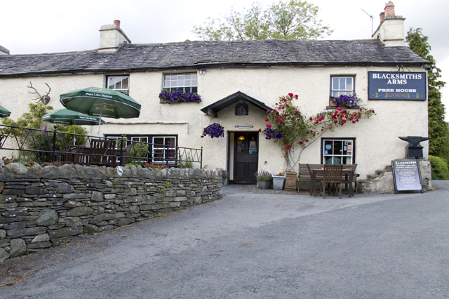
Blacksmiths Arms, Broughton Mills
- Overview Map Street View The Blacksmiths Arms is a public house and resturant located in Broughton Mills. The pub has a datestone inscribed WE 1748. The Blacksmiths Arms is Grade …
Co-Curate Page
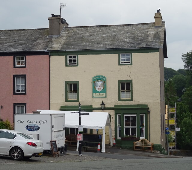
Manor Arms Hotel, Broughton-in-Furness
- Overview Map Street View The Manor Arms Hotel is located on the east side of The Square in Broughton-in-Furness. It is part of a terrace, including 7 houses, built in …
Co-Curate Page
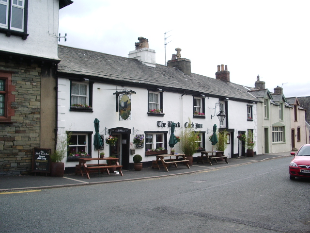
Black Cock Inn, Broughton-in-Furness
- The Black Cock Inn is a public house on Princes Street in Broughton-in-Furness. The building dates from the 17th century, with later alterations.[1] It is a Grade II listed building …


Co-Curate Page
Church of St Mary Magdalene, Broughton-in-Furness
- The Church of St Mary Magdalene in Broughton-in-Furness dates from the 12th century. It has a Medieval south aisle, formerly nave and chancel, with C12th south entrance. C16th and C19th …

Co-Curate Page
War Memorial, Broughton-in-Furness
- The War Memorial in Broughton-in-Furness is located outside of the Church of Mary Magdalene. The memorial was unveiled on the 3rd April 1921 in a service attended by Mr G.H. …

Co-Curate Page
Old Kings Head, Broughton in Furness
- Overview Map Street View The Old Kings Head is an inn located on Station Road in Broughton-in-Furness. The building was first mentioned as Church House in 1666, but was likely …

Co-Curate Page
Obelisk and Stocks, Broughton-in-Furness
- Overview Map Street View The stone obelisk in The Square is a prominent focal point in Broughton-in-Furness. The obelisk was erected in 1810 to celebrate the Golden Jubilee of King …

Co-Curate Page
Shop Bridge and Boundary Stone, Broughton Mills
- Overview Map Street View Shop Bridge is a stone road bridge over the River Lickle at Broughton Mills. The segmental arched bridge dates from the 18th century, with later widening. …

Co-Curate Page
Blacksmiths Arms, Broughton Mills
- Overview Map Street View The Blacksmiths Arms is a public house and resturant located in Broughton Mills. The pub has a datestone inscribed WE 1748. The Blacksmiths Arms is Grade …

Co-Curate Page
Manor Arms Hotel, Broughton-in-Furness
- Overview Map Street View The Manor Arms Hotel is located on the east side of The Square in Broughton-in-Furness. It is part of a terrace, including 7 houses, built in …


