Topics > Northumberland > Hobberlaw > High Hobberlaw
High Hobberlaw
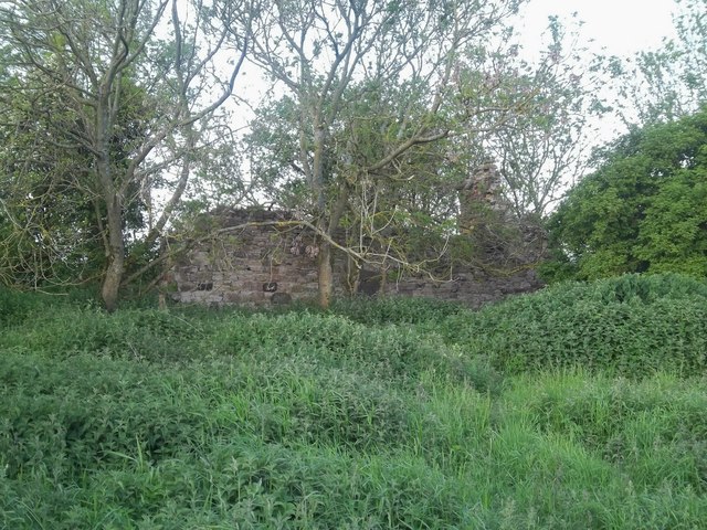
High Hobberlaw is a former farm, located to the south-west of Alnwick and to the north of Hobberlaw. A couple of ruined buildings remain. Alnwick Racecource was located here for a time; Alnwick & District Local History Society note that a 1 mile straight was established at High Hobberlaw, and the first official race was held on April 1654.[1] The race course later moved further east to Hobberlaw Edge; Alnwick Races are now held at Ratcheugh. There are a pair of Lime Kilns located south-west of High Hobberlaw.


from http://www.alnwicklhs.org.uk/…
Alnwick Race Course
- 1 mile straight at High Hobberlaw.
The first official race was April 1654. The race course later moved further east to Hobberlaw Edge. Detailed Alnwick results were first published in …
Added by
Simon Cotterill

Co-Curate Page
Lime Kilns, Hobberlaw
- Overview Map There are a pair of lime kilns located to the north-west of Hobberlaw and south-west of High Hobberlaw. They probably date from the 19th century, with the eastern …

from http://www.alnwicklhs.org.uk/…
Alnwick Race Course
- 1 mile straight at High Hobberlaw.
The first official race was April 1654. The race course later moved further east to Hobberlaw Edge. Detailed Alnwick results were first published in …
Added by
Simon Cotterill


