Topics > Civil Parishes in Cumbria > Burgh by Sands Civil Parish > Canal Aqueduct, west of Boustead Hill
Canal Aqueduct, west of Boustead Hill
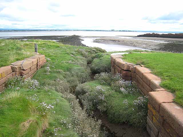
This old red brick bridge, west of Boustead Hill by the Solway Firth, was originally an aqueduct for the Carlisle Canal, built 1819-1823. It has two small round brick arches with plank doors on the seaward side, to prevent sea water from flowing into French Creek. When the canal closed in 1853, the aqueduct was converted to a railway bridge and was in use until the closure of the Silloth Branch line in 1964. The old aqueduct is Grade II listed on the National Heritage List for England. It straddles the civil parishes of Bowness and Burgh by Sands. The bridge can be seen (and easily missed!) from the Hadrian's Cycleway (National Route 72).


from https://historicengland.org.u…
Canal Aqueduct - Burgh / Bowness - List Entry
- Canal aqueduct, later railway bridge. 1819-1823 for the Carlisle Canal. Brick
with red sandstone coping. 2 small round brick arches with plank doors on the
seaward side, to prevent sea …
Added by
Simon Cotterill

from https://historicengland.org.u…
Canal Aqueduct - Burgh / Bowness - List Entry
- Canal aqueduct, later railway bridge. 1819-1823 for the Carlisle Canal. Brick
with red sandstone coping. 2 small round brick arches with plank doors on the
seaward side, to prevent sea …
Added by
Simon Cotterill