Topics > Tyne and Wear > North Tyneside > Tynemouth > Map and Aerial View
Map and Aerial View
Google Map: drag to move the view, zoom in and out using the control (lower right-hand corner); switch to map view (lower left-hand control)
from http://www.northtyneside.gov.…
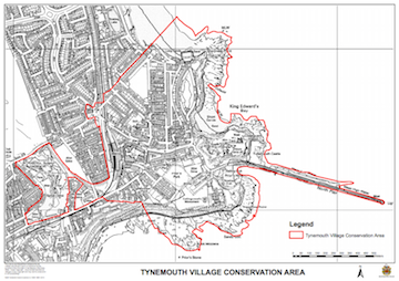
Map of the Tynemouth Village Conservation Area
- North Tyneside Council
Added by
Simon Cotterill

from http://www.northtyneside.gov.…
Map of the Tynemouth Village Conservation Area
- North Tyneside Council
Added by
Simon Cotterill