Topics > Heritage Sites > Listed Buildings > Scheduled Ancient Monument
Co-Curate Page
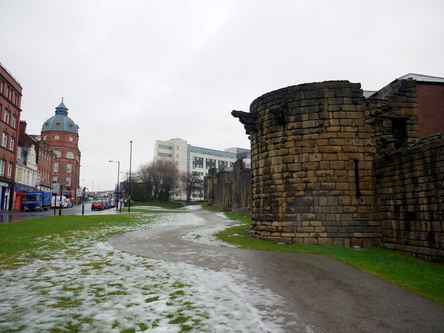
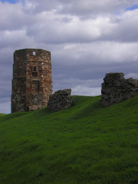
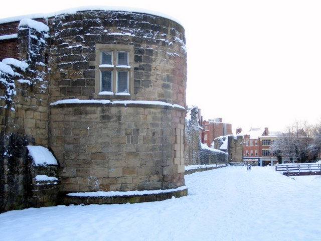
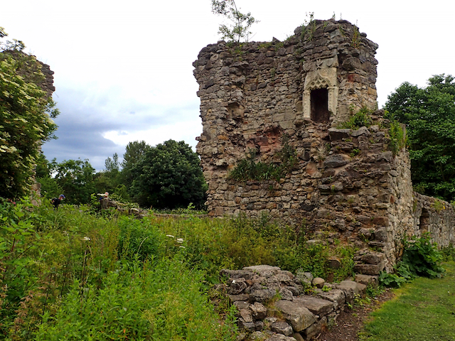
Durham Tower
- Overview Map Street View Built during the late 13th century, this was a single-storey semi-circular tower with a strong rib-vaulted room. The section of wall, including Durham Tower, is amongst …
Co-Curate Page
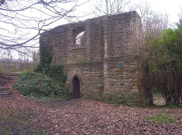
St Catherines Chapel, Hylton
- Overview Map Street View The chapel, located near Hyton Castle, dates back to at least the 12th Century and is a Scheduled Ancient Monument and a Grade 1 listed building.
Co-Curate Page
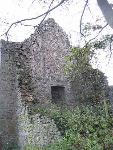
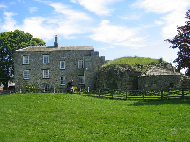
Scargill Castle
- Overview Map Scargill was originally built in the late 12th century by Warren de Scargill whilst he was overseeing building work at the nearby Bowes Castle. King Edward II is …
Co-Curate Page
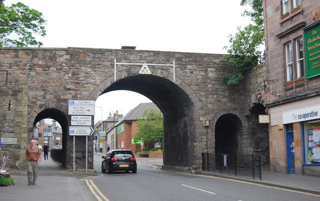
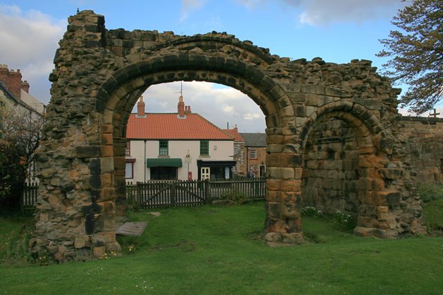
Scotsgate
- Overview Map Street View Scotsgate is part of the defensive Town Walls in Berwick-upon-Tweed. It dates from Elizabethan times, altered in 1815 and again in 1858.[1] Scotsgate, between the streets …
Co-Curate Page
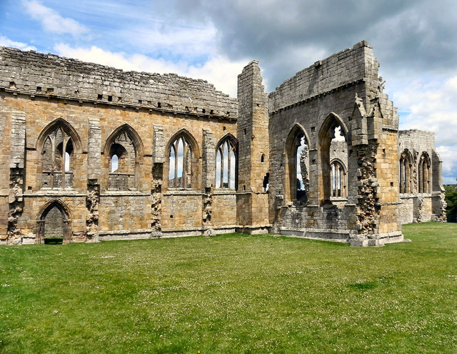
Egglestone Abbey
- Overview About Egglestone Abbey Map Street View Egglestone Abbey is an abandoned Premonstratensian Abbey on the southern (Yorkshire) bank of the River Tees, 1 1⁄2 miles (2.4 km) south-east of …
Co-Curate Page
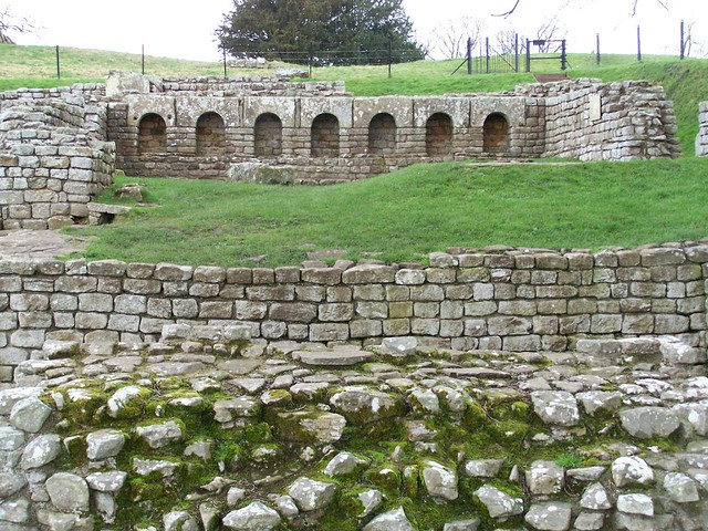
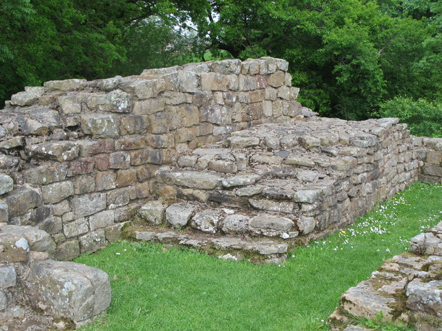
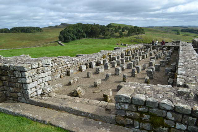
Chesters Roman Fort
- Overview About Chesters (Cilurnum) Map Chesters Roman Fort and Museum, managed by English Heritage, is located near Walwick and Chollerford in Northumberland. The Roman cavalry fort (Cilurnum) was built in …
Co-Curate Page
Legs Cross
- Overview Map Street View Near Bolam, County Durham. "The base and fragment of a cross shaft dating from the 9th century. A rough cut rectangular sandstone base, badly worn, but …
Co-Curate Page
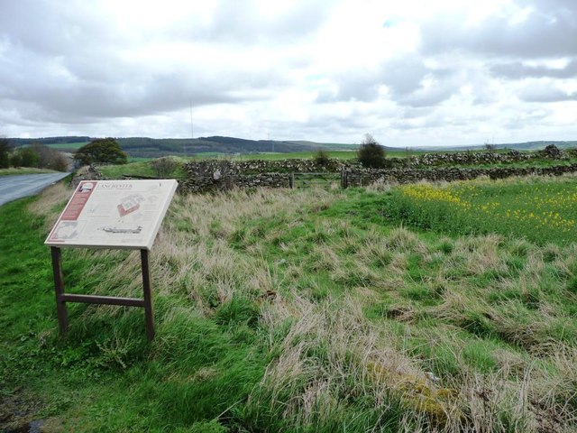
Longovicium, Lanchester Roman Fort
- Overview About Longovicium Map Street View Longovicium was a Roman fort established in the mid 2nd century AD, which lay on Dere Street, the Roman road connecting York with the …
Co-Curate Page
Burradon Tower
- Overview About Burradon Tower Map Burradon Tower is a ruined Pele Tower (defensive tower) in Burradon, built during times of hostilities with Scotland. The Tower is a Grade II listed …
Co-Curate Page
North Gosforth Chapel (ruins)
- Overview Map Street View The remains of the medieval chapel in North Gosforth were uncovered when the Melton Park housing estate was built in the 1950s.[1] The earliest documentary reference …
Co-Curate Page
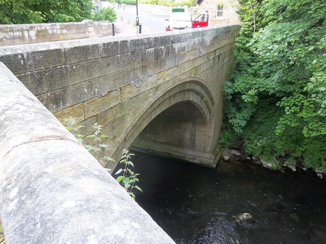
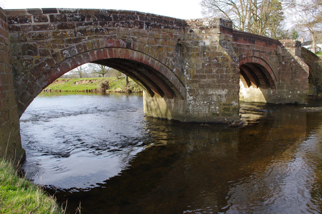
Old Bridge
- Overview Map Street View The old stone bridge over the River Aln at Lesbury dates from the 15th century, though substantially altered in the 19th century. The bridge is Grade …
Co-Curate Page
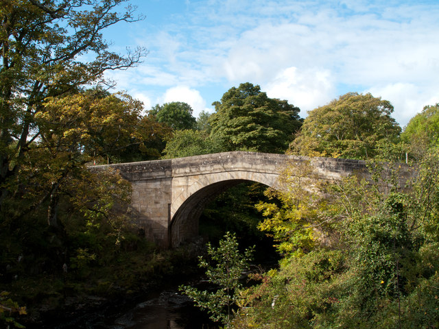
Bridge over the Wear
- Overview Map Street View This stone bridge over the River Wear just west of Stanhope dates from medieval times. The bridge now carries the B6278 road. It is Grade II* …
Co-Curate Page
Morden Tower
- Overview About the Tower & Poetry Centre Map Morden Tower is a turret on the west section of the Town Walls in Newcastle dating from 1280. Eneas Mackenzie, wrote in …

Co-Curate Page
St Mary's Chapel
- Overview Map Street View Pilgrim Street in Newcastle is so named because of the many pilgrims traveling that way to St Mary's Chapel in Jesmond; "THERE was an Inn in …
Co-Curate Page
House of Adam of Jesmond
- Overview Map Street View The House of Adam in Heaton Park in Heaton dates back to at least 1267.[1] It was the camera (seat) of Adam de Gesmuth (Adam of Jesmond), …
Co-Curate Page
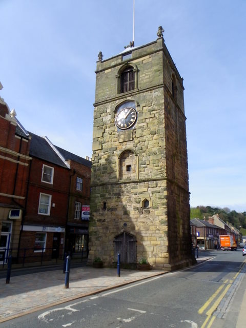
Clock Tower
- Overview About the Clock Tower Map Street View The Clock Tower on Old Gate in Morpeth was built in the early 17th century, using stone from an earlier Medieval building. …
Co-Curate Page
Medieval Preceptory, Low Chibburn
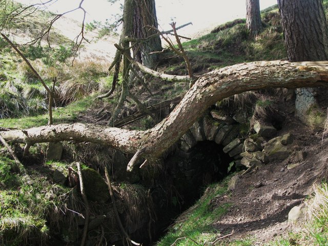
- In Low Chibburn, near Widdrington, are the remains of a preceptory (monestary) of the Knights Hospitallers. The buildings stood beside the Dunbar Burn, a small stream, used to feed a …
Co-Curate Page
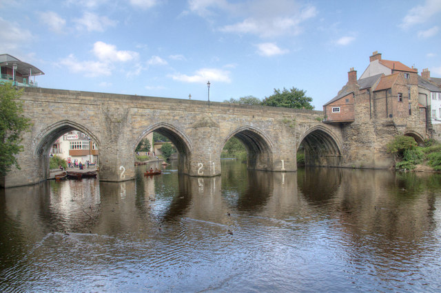
Framwellgate Bridge
- Overview About Framwellgate Bridge Map Street View Framwellgate Bridge is a medieval stone bridge over the River Wear in Durham. The bridge was built in the 15th century and replaced …
Co-Curate Page
Habitancum Roman Fort
- Overview About Habitancum Habitancum was an ancient Roman fort (castra) located at Risingham, Northumberland, England. The fort was one of the defensive structures built along Dere Street, a Roman road …
Co-Curate Page
Simonburn Castle
- Ruins of a 13th century tower house near Simonburn in Northumberland.
Co-Curate Page
Friarside Chapel, nr Burnopfield
- Overview Map High Friarside Hospice was a Medieval leper hospital, located just south of the River Derwent, north of Burnopfield and south of Rowlands Gill, in County Durham. The hospital was founded …
Co-Curate Page
Deserted Medieval Village and Chapel, Tughall
- The village of Tughall was recorded as being part of the barony of Alnwick in 1242. The ruins of its 12th century chapel and its graveyard are located at the …
Co-Curate Page
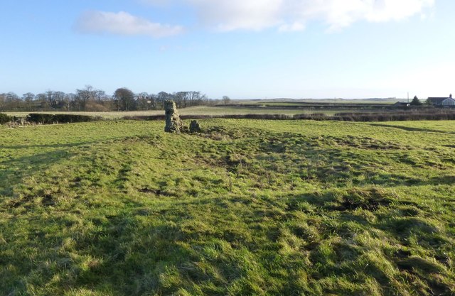
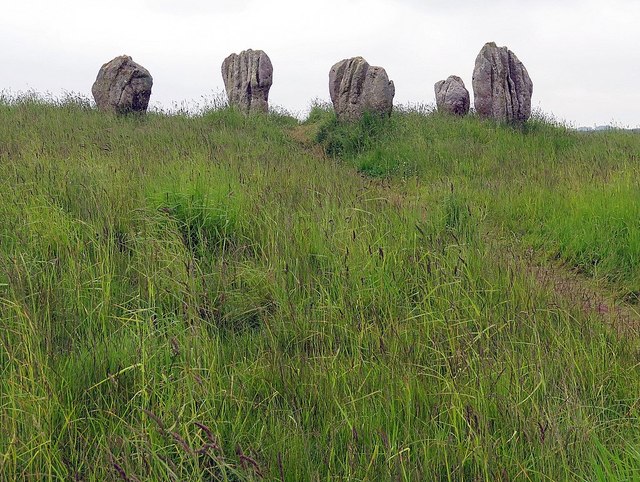
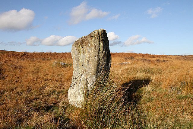
Duddo Stone Circle
- Overview About Duddo Stone Circle Map Street View Northumberland's answer to Stonehenge! The stone circle is located just under a mile north of Duddo, close to the border with Scotland. …

Co-Curate Page
Grindon School Roman Camp
- Overview Map There was a Roman temporary camp at Grindon, just south of Hadrian's Wall. There are few visible remains today because of farming over the years. It survives as …
Co-Curate Page
Wardley Medieval Moated Site
- There are earthwork remains at Wardley, Gateshead, of a medieval moated site and associated rig and furrow cultivation. This is a Scheduled Ancient Monument, though little of the remains can …
Co-Curate Page
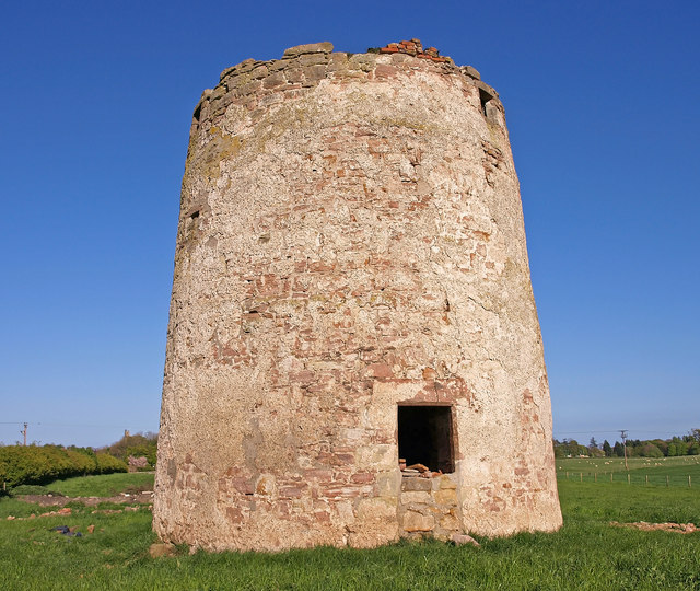
Haggerston Dovecote
- Overview Map Street View This round stone dovecote is located a quarter mile west of Haggerston Castle in Northumberland. It is thought to have been originally been built as a …
Co-Curate Page
Poltross Burn Milecastle, Hadrian's Wall
- Overview About Milecastle 48 Map Street View Poltross Burn, located near Gilsland, is one of the best-preserved milecastles on Hadrian's Wall. It is larger than most other milecastles, housing two …
Co-Curate Page
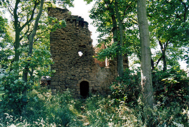
Dalden Tower
- Overview Map Street View Dalden Tower, is located in Seaham in the Dean which runs to Dalton-le-Dale. The pele-tower is the most prominent part of the remains of what was …
Co-Curate Page
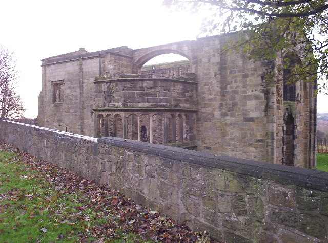
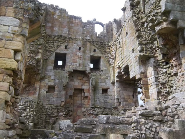
Edlingham Castle
- Overview About Edlingham Castle Map Street View The ruins of Edlingham Castle are located to the north-east of the village of Edlingham, about 6 miles north-east of Rothbury. The 'castle' was …
Co-Curate Page
Fenham Monastic Grange (ruins)
- Overview Map Aerial View There are ruins of a monastic grange at Fenham in Northumberland - a farm complex owned by the Benedictine priory of Lindisfarne, on nearby Holy Island. …
Co-Curate Page
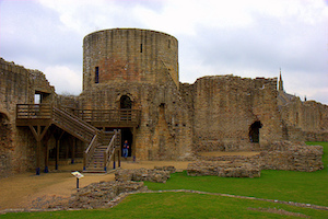
Barnard Castle (castle)
- Overview About Barnard Castle Map Street View The medieval castle in the town of Barnard Castle, is cared for by English Heritage. The castle is a Scheduled Ancient Monument, and …
Co-Curate Page
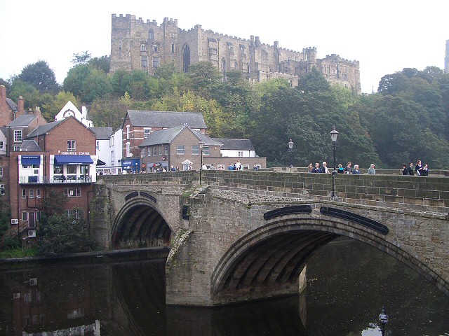
Elvet Bridge
- Overview Further Information Map Street View Elvet Bridge is a stone bridge which crosses the River Wear connecting the peninsula in central Durham and the Elvet area of the city. …
Co-Curate Page
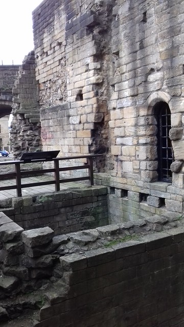
Clifford's Fort
- Overview History of Clifford's Fort Maps Street View Clifford's Fort was a gun battery and military barracks built to defend the mouth of the River Tyne, at the east of …
Co-Curate Page
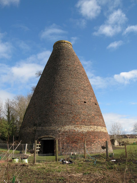
Bottle kilns
- Overview Map Street View Walker's Pottery on Milkwell Lane in Corbridge operated from the early 19th century until 1910. The pottery produced pipes, tiles and low-grade pottery for agricultural use, …
Co-Curate Page
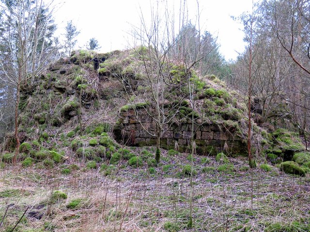
Mohope Lead Mines
- The Mohope Head Lead Mine and associated ore works were operating between the 1820s and the 1850s. The remains of the lead mine which are still visible today include an …
Co-Curate Page
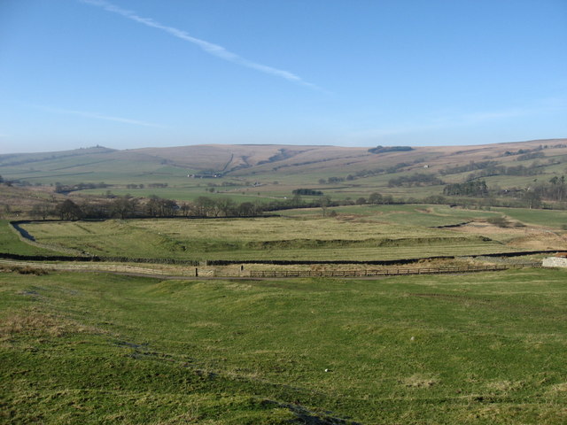
Pawston Hill - Iron Age Hillfort
- The remains of an Iron Age hillfort are located on Pawston Hill, located to the south-west of the hamlet of Pawston and just to the north-west of Pawston Lake in …
Co-Curate Page
Housesteads
- Overview About Howsteads Fort Map Street View Interactive Glossary Housesteads (Roman name: "Vercovicium") is one of the best preserved forts on Hadrian's Wall, built around 124 AD. The fort covers …
Co-Curate Page
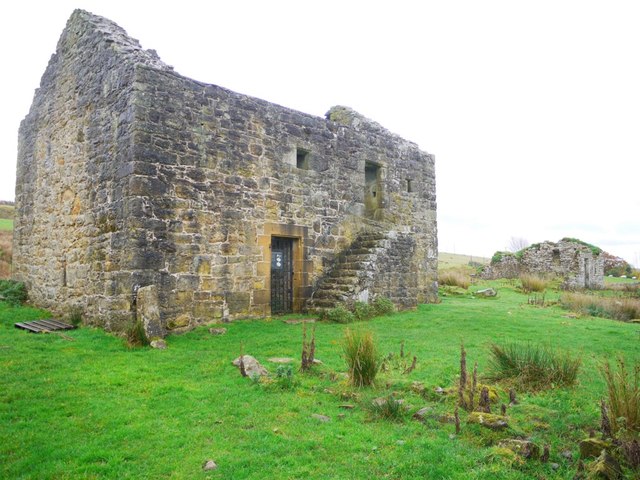
Black Middens Bastle House
- Overview About Black Middens Bastle Map Street View Black Middens Bastle House is at an isolated location on the north side of the Tarset Valley, about 2 miles north-west of …
Co-Curate Page
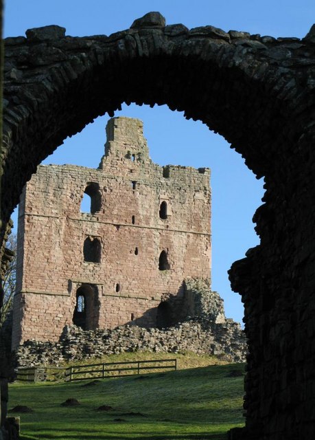
Norham Castle
- Overview About Norham Castle Map Street View Norham Castle is a castle in Northumberland, England, overlooking the River Tweed, on the border between England and Scotland. It is a …
Co-Curate Page
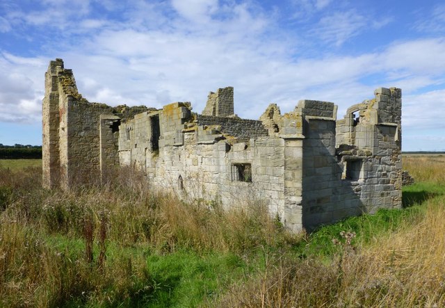
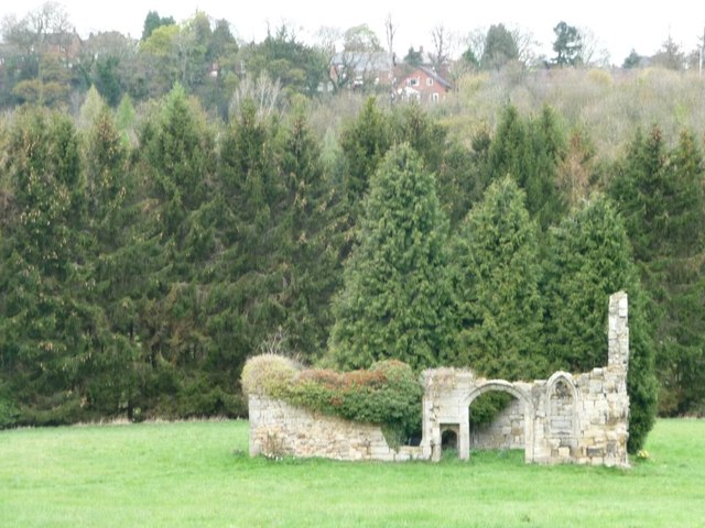
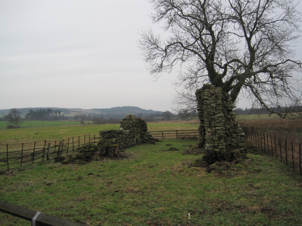
Newminster Abbey (ruins)
- The ruins of Newminster Abbey are located on the west side of Morpeth, near the south banks of the River Wansbeck. This Cistercian abbey was founded in 1137; most of …
Co-Curate Page
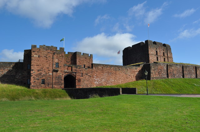
Carlisle Castle
- Overview About Carlisle Castle Map Street View Carlisle Castle is built on the site of a Roman fort (known as Luguvalium). Construction of a motte and bailey castle began in …
Co-Curate Page
Heron Pit Prison and Drawbridge Pit, by Black Gate
- Barbican, prison and pits dating from the mid 13th and 17th century. Grade I listed. The information board by the pit states: "William Heron - The Hammer of the Poor …
Co-Curate Page
Kendal Castle
- Overview About Kendal Castle Map Street View The ruins of Kendal Castle are located on the east side of the River Kent on Castle Hill (a large glacial moraine), overlooking …
Co-Curate Page
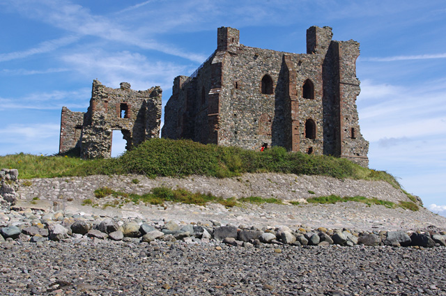
Piel Castle
- Overview About Piel Castle Map Street View Piel Castle, also known as Fouldry Castle or the Pile of Fouldray, is a castle situated on the south-eastern point of Piel …
Co-Curate Page
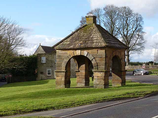
Market Cross
- Overview Map Street View The Market Cross (aka "Butter Cross") is located on the western side of the village green in Stamfordham. It is a small square, single-storey building, with …
Co-Curate Page
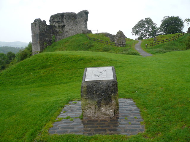
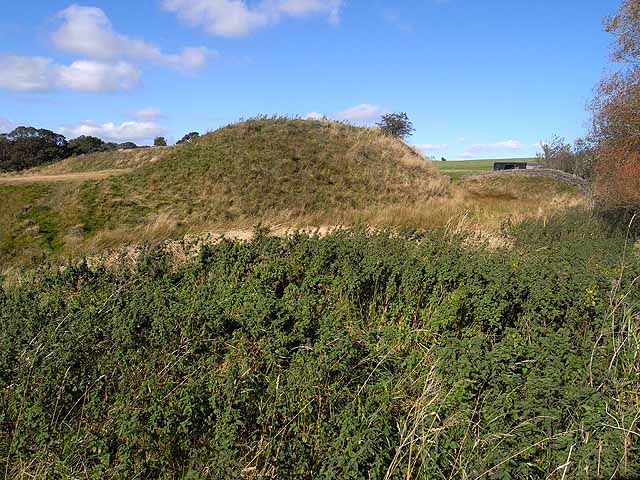
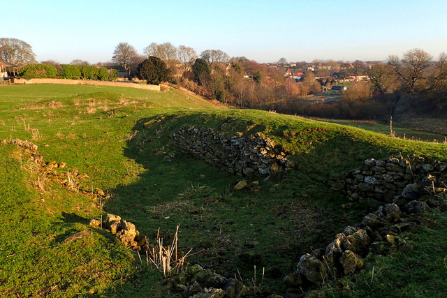
Mote Hills (Elsdon Castle)
- Overview About Elsdon Castle Map Street View Mote Hills at the village of Elsdon are the earthwork remains of a medieval motte and bailey castle. The castle was built on …
Co-Curate Page
Millom Castle
- Overview About Millom Castle Map Street View About half a mile north of Millom town centre are the ruins of Millom Castle. The site was a moated manor house and …
Co-Curate Page
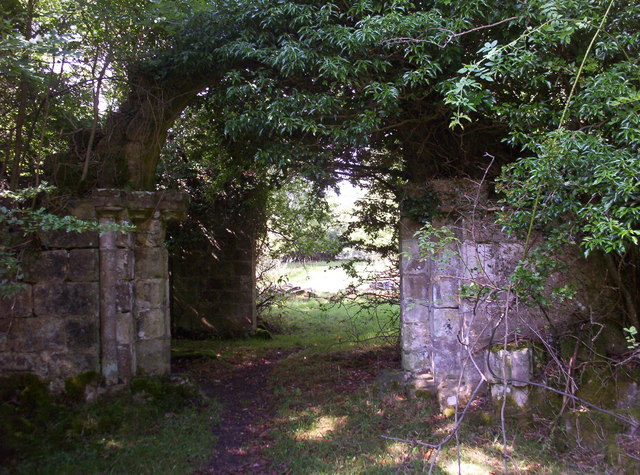
Bewley Castle (ruins)
- Bewley Castle, now in ruins, was once the residence of Bishops of Carlisle. The original castle here ('Bellus Locus') is thought to have been built by Bishop Hugh who died in …
Co-Curate Page
St Leonard's Hospital (ruins), Denwick
- Overview Map Street View The remains of the medieval St Leonard's Hospital are beside the B6341 road, about ¾ mile north of Alnwick and a mile west of the village of …
Co-Curate Page
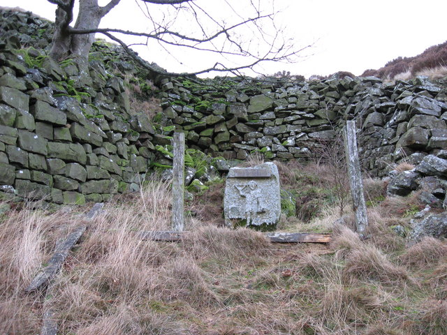
Robin of Risingham
- "Robin of Risingham" is a Roman rock carving located between Ridsdale and West Woodburn, and about ½ mile south-east of Habitancum Roman Fort. The carving of a figure holding a …
Co-Curate Page
Middleham Castle
- Middleham Castle was the main house of the Bishops of Durham from the Norman Conquest (1066) to the end of the 14th century. It was a fortified manor house, located …

Co-Curate Page
Priory Gatehouse, Wetheral
- Overview Map Street View The Gatehouse Tower for the former Benedictine Priory at Wetheral dates from the 15th century. The priory was founded in c.1100, but the gatehouse is thought …

Co-Curate Page
Durham Tower
- Overview Map Street View Built during the late 13th century, this was a single-storey semi-circular tower with a strong rib-vaulted room. The section of wall, including Durham Tower, is amongst …
Co-Curate Page
St Catherines Chapel, Hylton
- Overview Map Street View The chapel, located near Hyton Castle, dates back to at least the 12th Century and is a Scheduled Ancient Monument and a Grade 1 listed building.
Co-Curate Page
Scargill Castle
- Overview Map Scargill was originally built in the late 12th century by Warren de Scargill whilst he was overseeing building work at the nearby Bowes Castle. King Edward II is …
Co-Curate Page
Scotsgate
- Overview Map Street View Scotsgate is part of the defensive Town Walls in Berwick-upon-Tweed. It dates from Elizabethan times, altered in 1815 and again in 1858.[1] Scotsgate, between the streets …
Co-Curate Page
Egglestone Abbey
- Overview About Egglestone Abbey Map Street View Egglestone Abbey is an abandoned Premonstratensian Abbey on the southern (Yorkshire) bank of the River Tees, 1 1⁄2 miles (2.4 km) south-east of …
Co-Curate Page
Chesters Roman Fort
- Overview About Chesters (Cilurnum) Map Chesters Roman Fort and Museum, managed by English Heritage, is located near Walwick and Chollerford in Northumberland. The Roman cavalry fort (Cilurnum) was built in …
Co-Curate Page
Legs Cross
- Overview Map Street View Near Bolam, County Durham. "The base and fragment of a cross shaft dating from the 9th century. A rough cut rectangular sandstone base, badly worn, but …
Co-Curate Page
Longovicium, Lanchester Roman Fort
- Overview About Longovicium Map Street View Longovicium was a Roman fort established in the mid 2nd century AD, which lay on Dere Street, the Roman road connecting York with the …
Co-Curate Page
Burradon Tower
- Overview About Burradon Tower Map Burradon Tower is a ruined Pele Tower (defensive tower) in Burradon, built during times of hostilities with Scotland. The Tower is a Grade II listed …
Co-Curate Page
North Gosforth Chapel (ruins)
- Overview Map Street View The remains of the medieval chapel in North Gosforth were uncovered when the Melton Park housing estate was built in the 1950s.[1] The earliest documentary reference …
Co-Curate Page
Old Bridge
- Overview Map Street View The old stone bridge over the River Aln at Lesbury dates from the 15th century, though substantially altered in the 19th century. The bridge is Grade …
Co-Curate Page
Bridge over the Wear
- Overview Map Street View This stone bridge over the River Wear just west of Stanhope dates from medieval times. The bridge now carries the B6278 road. It is Grade II* …
Co-Curate Page
Morden Tower
- Overview About the Tower & Poetry Centre Map Morden Tower is a turret on the west section of the Town Walls in Newcastle dating from 1280. Eneas Mackenzie, wrote in …
Co-Curate Page
St Mary's Chapel
- Overview Map Street View Pilgrim Street in Newcastle is so named because of the many pilgrims traveling that way to St Mary's Chapel in Jesmond; "THERE was an Inn in …
Co-Curate Page
House of Adam of Jesmond
- Overview Map Street View The House of Adam in Heaton Park in Heaton dates back to at least 1267.[1] It was the camera (seat) of Adam de Gesmuth (Adam of Jesmond), …
Co-Curate Page
Clock Tower
- Overview About the Clock Tower Map Street View The Clock Tower on Old Gate in Morpeth was built in the early 17th century, using stone from an earlier Medieval building. …
Co-Curate Page
Medieval Preceptory, Low Chibburn
- In Low Chibburn, near Widdrington, are the remains of a preceptory (monestary) of the Knights Hospitallers. The buildings stood beside the Dunbar Burn, a small stream, used to feed a …
Co-Curate Page
Framwellgate Bridge
- Overview About Framwellgate Bridge Map Street View Framwellgate Bridge is a medieval stone bridge over the River Wear in Durham. The bridge was built in the 15th century and replaced …
Co-Curate Page
Habitancum Roman Fort
- Overview About Habitancum Habitancum was an ancient Roman fort (castra) located at Risingham, Northumberland, England. The fort was one of the defensive structures built along Dere Street, a Roman road …
Co-Curate Page
Simonburn Castle
- Ruins of a 13th century tower house near Simonburn in Northumberland.
Co-Curate Page
Friarside Chapel, nr Burnopfield
- Overview Map High Friarside Hospice was a Medieval leper hospital, located just south of the River Derwent, north of Burnopfield and south of Rowlands Gill, in County Durham. The hospital was founded …
Co-Curate Page
Deserted Medieval Village and Chapel, Tughall
- The village of Tughall was recorded as being part of the barony of Alnwick in 1242. The ruins of its 12th century chapel and its graveyard are located at the …
Co-Curate Page
Duddo Stone Circle
- Overview About Duddo Stone Circle Map Street View Northumberland's answer to Stonehenge! The stone circle is located just under a mile north of Duddo, close to the border with Scotland. …
Co-Curate Page
Grindon School Roman Camp
- Overview Map There was a Roman temporary camp at Grindon, just south of Hadrian's Wall. There are few visible remains today because of farming over the years. It survives as …
Co-Curate Page
Wardley Medieval Moated Site
- There are earthwork remains at Wardley, Gateshead, of a medieval moated site and associated rig and furrow cultivation. This is a Scheduled Ancient Monument, though little of the remains can …
Co-Curate Page
Haggerston Dovecote
- Overview Map Street View This round stone dovecote is located a quarter mile west of Haggerston Castle in Northumberland. It is thought to have been originally been built as a …
Co-Curate Page
Poltross Burn Milecastle, Hadrian's Wall
- Overview About Milecastle 48 Map Street View Poltross Burn, located near Gilsland, is one of the best-preserved milecastles on Hadrian's Wall. It is larger than most other milecastles, housing two …
Co-Curate Page
Dalden Tower
- Overview Map Street View Dalden Tower, is located in Seaham in the Dean which runs to Dalton-le-Dale. The pele-tower is the most prominent part of the remains of what was …
Co-Curate Page
Edlingham Castle
- Overview About Edlingham Castle Map Street View The ruins of Edlingham Castle are located to the north-east of the village of Edlingham, about 6 miles north-east of Rothbury. The 'castle' was …
Co-Curate Page
Fenham Monastic Grange (ruins)
- Overview Map Aerial View There are ruins of a monastic grange at Fenham in Northumberland - a farm complex owned by the Benedictine priory of Lindisfarne, on nearby Holy Island. …
Co-Curate Page
Barnard Castle (castle)
- Overview About Barnard Castle Map Street View The medieval castle in the town of Barnard Castle, is cared for by English Heritage. The castle is a Scheduled Ancient Monument, and …
Co-Curate Page
Elvet Bridge
- Overview Further Information Map Street View Elvet Bridge is a stone bridge which crosses the River Wear connecting the peninsula in central Durham and the Elvet area of the city. …
Co-Curate Page
Clifford's Fort
- Overview History of Clifford's Fort Maps Street View Clifford's Fort was a gun battery and military barracks built to defend the mouth of the River Tyne, at the east of …
Co-Curate Page
Bottle kilns
- Overview Map Street View Walker's Pottery on Milkwell Lane in Corbridge operated from the early 19th century until 1910. The pottery produced pipes, tiles and low-grade pottery for agricultural use, …
Co-Curate Page
Mohope Lead Mines
- The Mohope Head Lead Mine and associated ore works were operating between the 1820s and the 1850s. The remains of the lead mine which are still visible today include an …
Co-Curate Page
Pawston Hill - Iron Age Hillfort
- The remains of an Iron Age hillfort are located on Pawston Hill, located to the south-west of the hamlet of Pawston and just to the north-west of Pawston Lake in …
Co-Curate Page
Housesteads
- Overview About Howsteads Fort Map Street View Interactive Glossary Housesteads (Roman name: "Vercovicium") is one of the best preserved forts on Hadrian's Wall, built around 124 AD. The fort covers …
Co-Curate Page
Black Middens Bastle House
- Overview About Black Middens Bastle Map Street View Black Middens Bastle House is at an isolated location on the north side of the Tarset Valley, about 2 miles north-west of …
Co-Curate Page
Norham Castle
- Overview About Norham Castle Map Street View Norham Castle is a castle in Northumberland, England, overlooking the River Tweed, on the border between England and Scotland. It is a …
Co-Curate Page
Newminster Abbey (ruins)
- The ruins of Newminster Abbey are located on the west side of Morpeth, near the south banks of the River Wansbeck. This Cistercian abbey was founded in 1137; most of …
Co-Curate Page
Carlisle Castle
- Overview About Carlisle Castle Map Street View Carlisle Castle is built on the site of a Roman fort (known as Luguvalium). Construction of a motte and bailey castle began in …
Co-Curate Page
Heron Pit Prison and Drawbridge Pit, by Black Gate
- Barbican, prison and pits dating from the mid 13th and 17th century. Grade I listed. The information board by the pit states: "William Heron - The Hammer of the Poor …
Co-Curate Page
Kendal Castle
- Overview About Kendal Castle Map Street View The ruins of Kendal Castle are located on the east side of the River Kent on Castle Hill (a large glacial moraine), overlooking …
Co-Curate Page
Piel Castle
- Overview About Piel Castle Map Street View Piel Castle, also known as Fouldry Castle or the Pile of Fouldray, is a castle situated on the south-eastern point of Piel …
Co-Curate Page
Market Cross
- Overview Map Street View The Market Cross (aka "Butter Cross") is located on the western side of the village green in Stamfordham. It is a small square, single-storey building, with …
Co-Curate Page
Mote Hills (Elsdon Castle)
- Overview About Elsdon Castle Map Street View Mote Hills at the village of Elsdon are the earthwork remains of a medieval motte and bailey castle. The castle was built on …
Co-Curate Page
Millom Castle
- Overview About Millom Castle Map Street View About half a mile north of Millom town centre are the ruins of Millom Castle. The site was a moated manor house and …
Co-Curate Page
Bewley Castle (ruins)
- Bewley Castle, now in ruins, was once the residence of Bishops of Carlisle. The original castle here ('Bellus Locus') is thought to have been built by Bishop Hugh who died in …
Co-Curate Page
St Leonard's Hospital (ruins), Denwick
- Overview Map Street View The remains of the medieval St Leonard's Hospital are beside the B6341 road, about ¾ mile north of Alnwick and a mile west of the village of …
Co-Curate Page
Robin of Risingham
- "Robin of Risingham" is a Roman rock carving located between Ridsdale and West Woodburn, and about ½ mile south-east of Habitancum Roman Fort. The carving of a figure holding a …
Co-Curate Page
Middleham Castle
- Middleham Castle was the main house of the Bishops of Durham from the Norman Conquest (1066) to the end of the 14th century. It was a fortified manor house, located …


