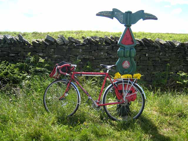
National Cycle Network milepost on the Stanegate


-
Description
"Hadrian's Cycleway (National Cycle Network route 72) LinkExternal link runs from South Shields (Arbeia) to Ravenglass (Glannaventa) and links many Roman sites on or near Hadrian's Wall. This milepost is one of many which were donated to the National Cycle Network project by the Royal Bank of Scotland and marks the highest point on the Hadrian's Cycleway at 265 m above sea level. This particular milepost is one of the "Welsh" design by the Welsh artist Andrew Rowe LinkExternal link. The red plaque is a component of the "Time Trail", a complex treasure-hunting spin-off of the project which very few people could get their heads round. Local groups and supporters are encouraged to paint the mileposts in their own colour scheme." Photo by Oliver Dixon, 2008, and licensed for reuse under a Creative Commons Licence. -
Owner
Geograph.org.uk -
Source
Geograph (Geograph) -
License
What does this mean? Attribution-ShareAlike 2.0 Generic (CC BY-SA 2.0)
-
Further information
Link: http://www.geograph.org.uk/photo/847015
Resource type: Text/Website
Added by: Simon Cotterill
Last modified: 10 years, 4 months ago
Viewed: 1193 times
Picture Taken: Unknown -
Co-Curate tags
")


