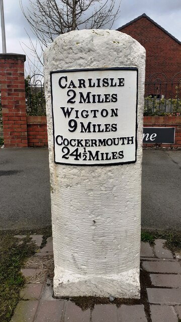
Milestone on NW side of Wigton Road 2 miles from Carlisle

-
Description
"Ordnance Survey documents describe a benchmark levelled at 151.720 feet above Liverpool Datum during the 1843/4 Kendal to Carlisle 1GL Survey on a milestone at this location. The surveyor's description was 'No. 379. Mark on top of the 2d milestone from Carlisle ; 2.91 ft. above surface'. No benchmark is now visible but appears to be present in a 2006 photo [[5622958]]" Photo by Roger Templeman, 2024. -
Owner
Roger Templeman -
Source
Geograph (Geograph) -
License
What does this mean? Creative Commons License
-
Further information
Link: http://www.geograph.org.uk/photo/7749309
Resource type: Image
Added by: Simon Cotterill
Last modified: 1 year, 9 months ago
Viewed: 294 times
Picture Taken: 2024-03-20 -
Co-Curate tags
")


